MyTopo
Bonduel Wisconsin US Topo Map
Couldn't load pickup availability
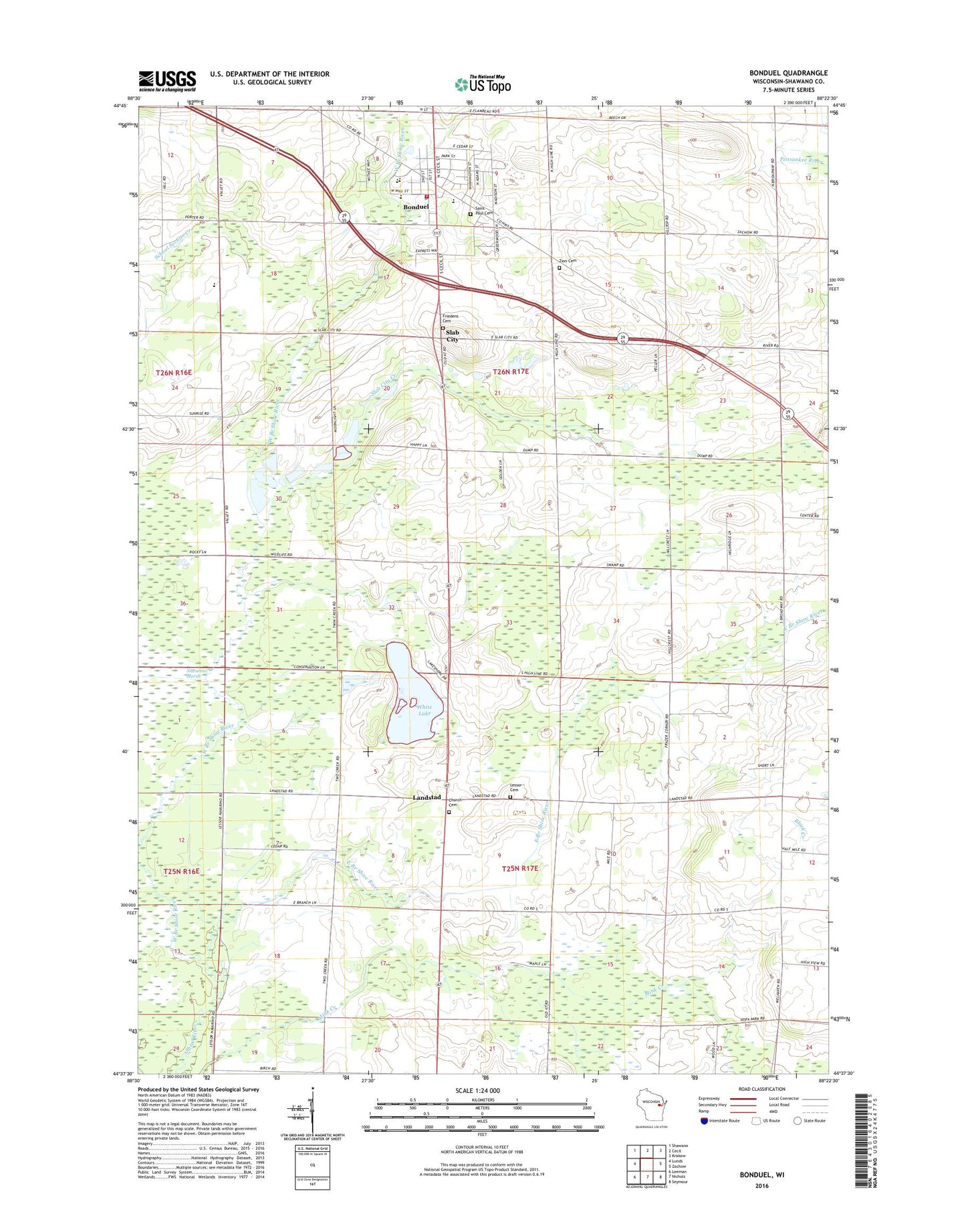
2022 topographic map quadrangle Bonduel in the state of Wisconsin. Scale: 1:24000. Based on the newly updated USGS 7.5' US Topo map series, this map is in the following counties: Shawano. The map contains contour data, water features, and other items you are used to seeing on USGS maps, but also has updated roads and other features. This is the next generation of topographic maps. Printed on high-quality waterproof paper with UV fade-resistant inks.
Quads adjacent to this one:
West: Lunds
Northwest: Shawano
North: Cecil
Northeast: Krakow
East: Zachow
Southeast: Seymour
South: Nichols
Southwest: Leeman
This map covers the same area as the classic USGS quad with code o44088f4.
Contains the following named places: Bonduel, Bonduel Elementary School, Bonduel Fire Department, Bonduel High School, Bonduel Middle School, Bonduel Police Department, Bonduel Post Office, Cedar Park, Deer View School, East Branch Shioc River, Emmanuel Lutheran Cemetery, Evergreen Cemetery, Friedens Evangelical Lutheran Cemetery, Landstad, Our Saviors Church, Saint Paul Cemetery, Saint Paul Lutheran School, Slab City, Slab City Creek, Town of Hartland, Town of Lessor, Village of Bonduel, West Branch Shioc River, White Lake, Zion Cemetery, ZIP Code: 54107