
MyTopo
Shennington Wisconsin US Topo Map
Couldn't load pickup availability
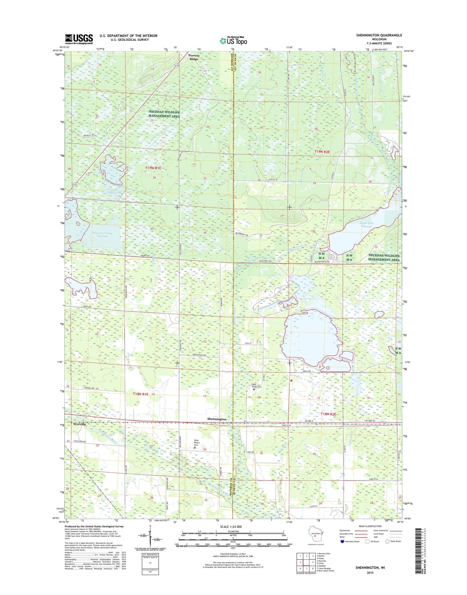
2018 topographic map quadrangle Shennington in the state of Wisconsin. Scale: 1:24000. Based on the newly updated USGS 7.5' US Topo map series, this map is in the following counties: Juneau, Monroe. The map contains contour data, water features, and other items you are used to seeing on USGS maps, but also has updated roads and other features. This is the next generation of topographic maps. Printed on high-quality waterproof paper with UV fade-resistant inks.
Quads adjacent to this one:
West: Wyeville
Northwest: Warrens East
North: Mather
Northeast: Finley
East: Cutler
Southeast: New Lisbon North
South: Camp Douglas
Southwest: Oakdale
Contains the following named places: 2 Reservoir, 5 Reservoir, Adventist Church, Beaver Creek, Beaver Creek 2 Dam, Campground Number Four, Cutler Ditch, Cutler Volunteer Fire Company, Dandy Creek, Dandy Creek 6 C6118d6 Dam, Dandy Creek 9 C6118-D9 Dam, Dandy Creek Flowage, Eagle Nest Flowage, East Fork Lemonweir River, Holiday Landing Strip, Mayflower School, Monroe County Flowage, Mud Ditch, Norway Ridge, Norway Ridge Lookout Tower, Potter Landing Strip, Potters Reservoir 2WP 188 Dam, Saint Johns Cemetery, Saint Peters Cemetery, Shennington, Silver Creek, South Fork Lemonweir River, Town of Byron, Town of Cutler, Town of Scott


