MyTopo
Wyeville Wisconsin US Topo Map
Couldn't load pickup availability
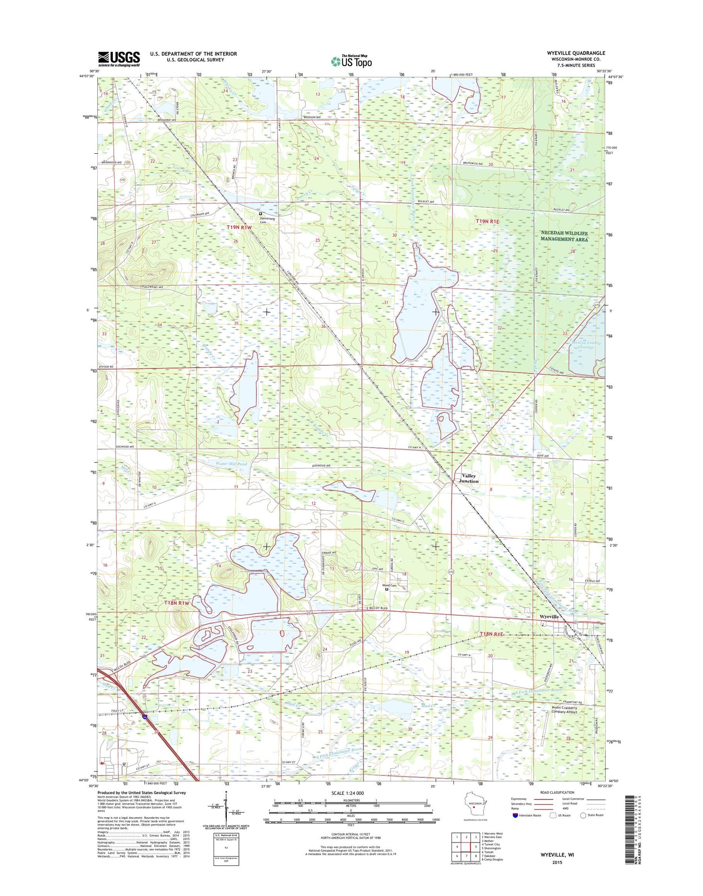
2022 topographic map quadrangle Wyeville in the state of Wisconsin. Scale: 1:24000. Based on the newly updated USGS 7.5' US Topo map series, this map is in the following counties: Monroe. The map contains contour data, water features, and other items you are used to seeing on USGS maps, but also has updated roads and other features. This is the next generation of topographic maps. Printed on high-quality waterproof paper with UV fade-resistant inks.
Quads adjacent to this one:
West: Tunnel City
Northwest: Warrens West
North: Warrens East
Northeast: Mather
East: Shennington
Southeast: Camp Douglas
South: Oakdale
Southwest: Tomah
This map covers the same area as the classic USGS quad with code o44090a4.
Contains the following named places: 136 Reservoir, Benjaminville School, Brandy Creek, Dandy Creek 11 2WP197 Dam, Dannavang Cemetery, Dannavang Church, Dead Creek, Jay Creek, Johnson C 12033 Dam, Kreyer Creek, Lake 18 13 22, Lake 26 2 and Lake 23 12d 13, Lake 32 11 57, Lake 5 7 58, Lowry Creek, Mill Creek, Mud Creek, North Tomah Cranberry Company 3WR483 Dam, Prehn Cranberry Company Airport, Salzwedel Cranberry Marsh, Sand Creek, Tomah Veterans Affairs Medical Center, Town of La Grange, Town of Lincoln, Valley Corporation Dam, Valley Junction, Valley View School, Veterans Affairs Fire Department, Village of Wyeville, Water Mill Dam, Water Mill Pond, Water Mill School, Wetherby Dam, Whisky Creek, Wood Cemetery, Wyeville, Wyeville Elementary School