MyTopo
Warrens East Wisconsin US Topo Map
Couldn't load pickup availability
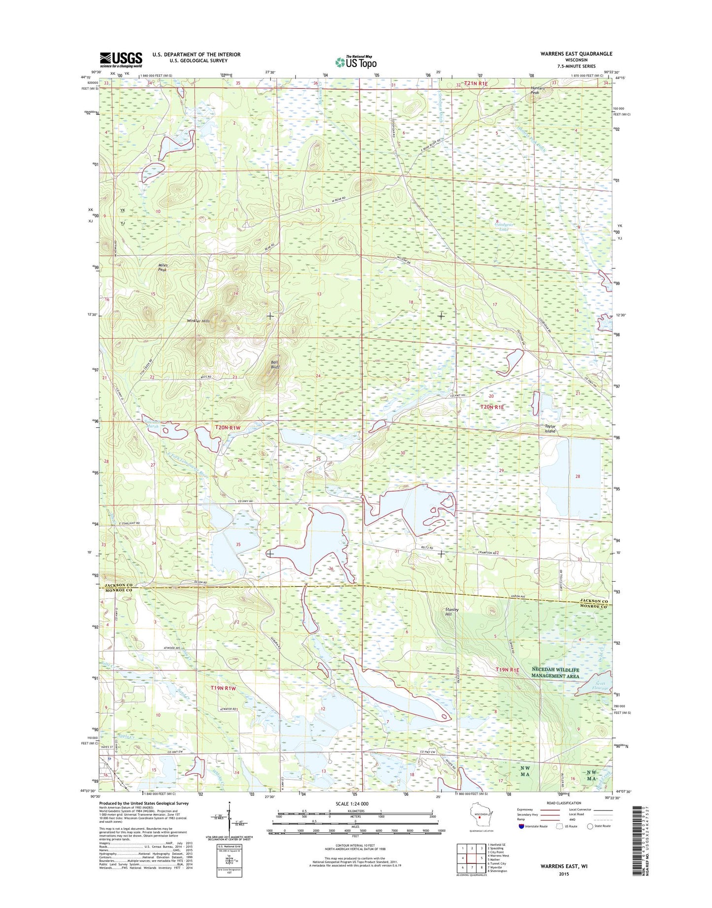
2022 topographic map quadrangle Warrens East in the state of Wisconsin. Scale: 1:24000. Based on the newly updated USGS 7.5' US Topo map series, this map is in the following counties: Jackson, Monroe. The map contains contour data, water features, and other items you are used to seeing on USGS maps, but also has updated roads and other features. This is the next generation of topographic maps. Printed on high-quality waterproof paper with UV fade-resistant inks.
Quads adjacent to this one:
West: Warrens West
Northwest: Hatfield SE
North: Spaulding
Northeast: City Point
East: Mather
Southeast: Shennington
South: Wyeville
Southwest: Tunnel City
This map covers the same area as the classic USGS quad with code o44090b4.
Contains the following named places: 5.46 Reservoir, 54666, Apple Creek, Ball Bluff, Bear Bluff Station, Beltz Creek, Goodyear Ditch, Goodyear Lake, Hunters Peak, Hunters Peak Ditch, Jensen Dam, Lake 1 8 Upper Reservoir 17.41, Lake 7-8 22, Lake 7-9 22, Miles Peak, North Scott Township Dam, Potter Dam, Sawdust Marsh, Scott Flowage, Stanley Hill, Strozewski Dam, Taylor Island, Town of Knapp, Warrens, Warrens Police Department, Warrens Post Office, Winkler Hills