MyTopo
Sister Bay Wisconsin US Topo Map
Couldn't load pickup availability
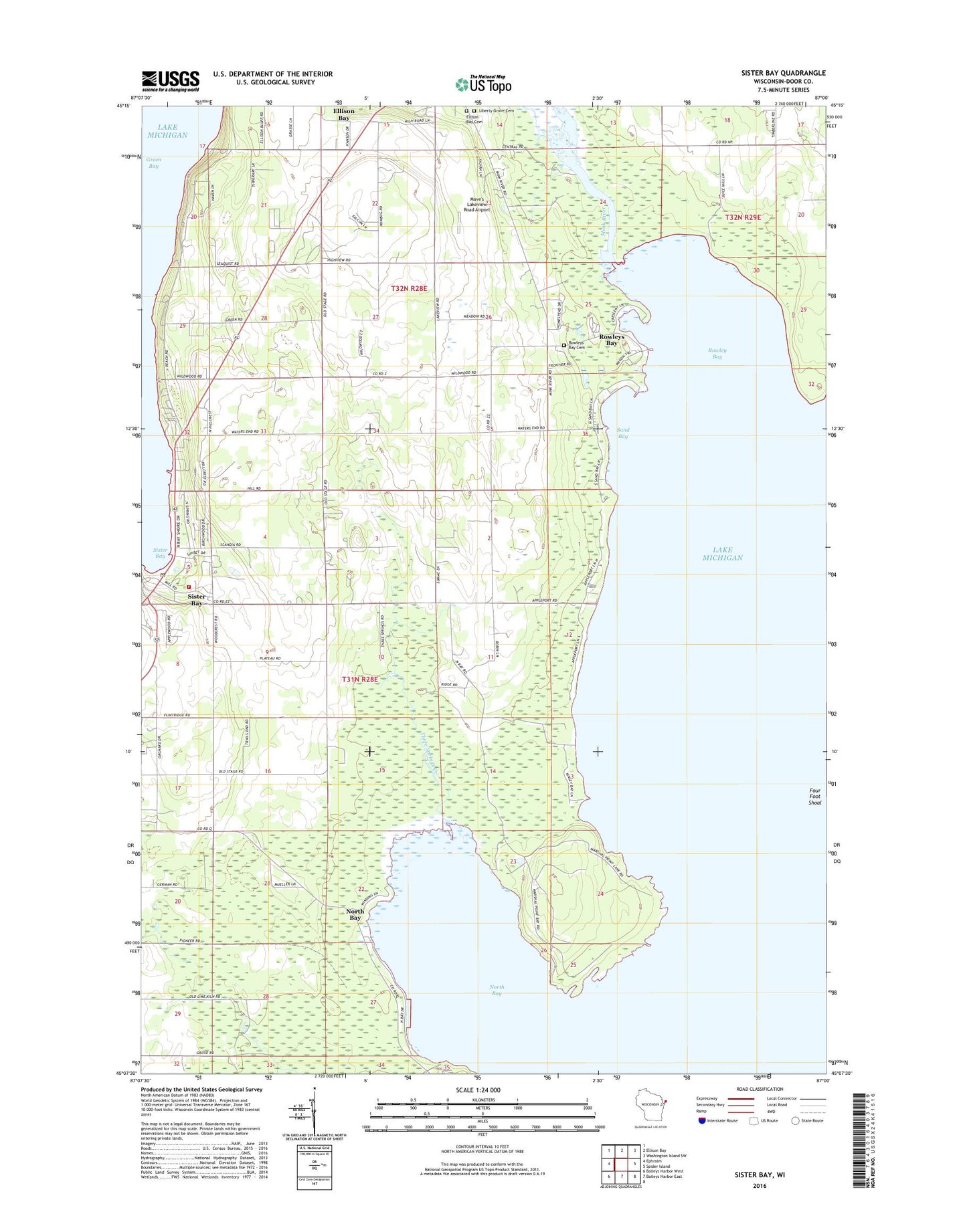
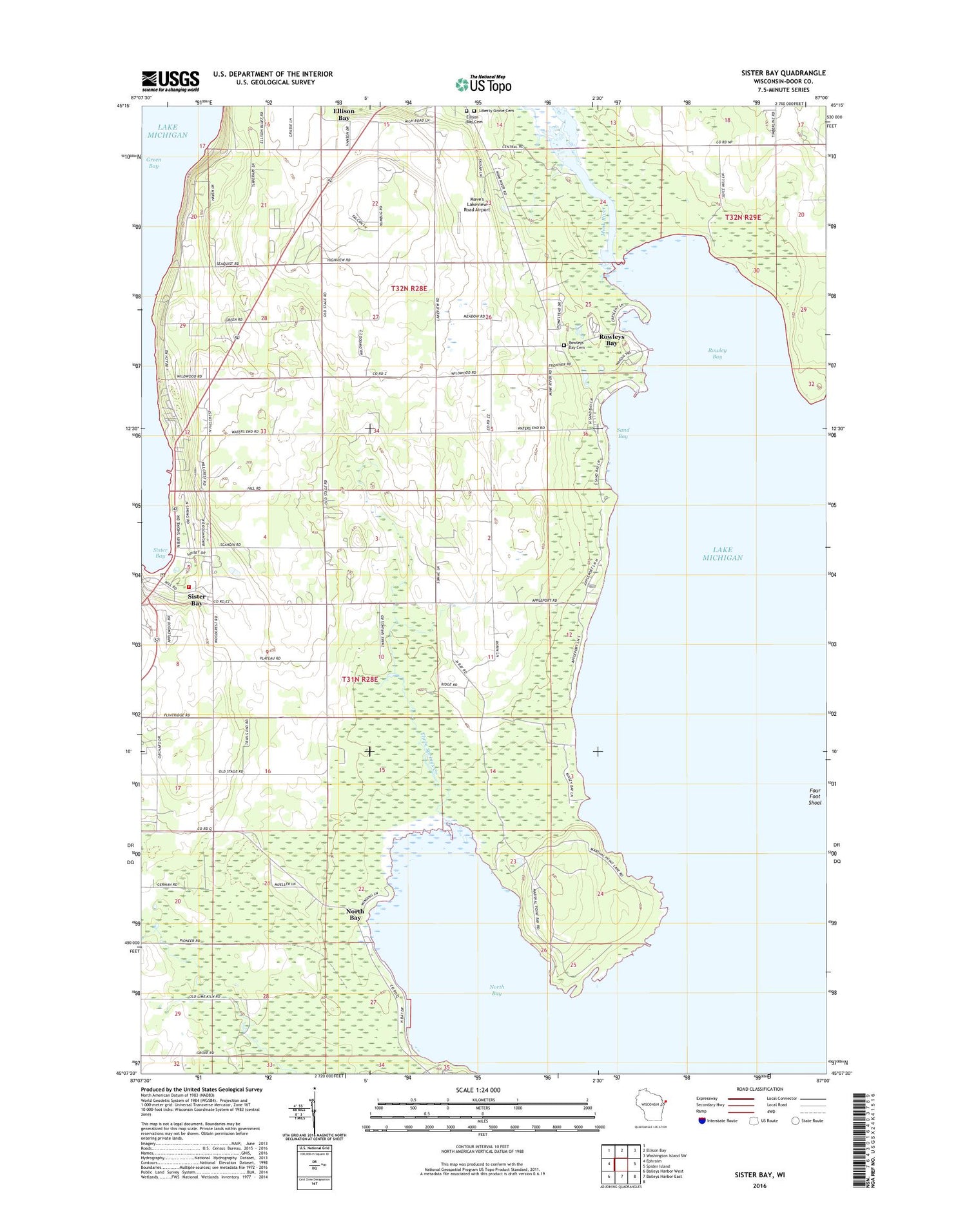
2018 topographic map quadrangle Sister Bay in the state of Wisconsin. Scale: 1:24000. Based on the newly updated USGS 7.5' US Topo map series, this map is in the following counties: Door. The map contains contour data, water features, and other items you are used to seeing on USGS maps, but also has updated roads and other features. This is the next generation of topographic maps. Printed on high-quality waterproof paper with UV fade-resistant inks.
Quads adjacent to this one:
West: Ephraim
North: Ellison Bay
Northeast: Washington Island SW
East: Spider Island
South: Baileys Harbor East
Southwest: Baileys Harbor West
Contains the following named places: A A Ranch of Wisconsin, Appleport School, Door County Library Sister Bay - Liberty Grove Branch, Ellison Bay Cemetery, Fierce Farms, Four Foot Shoal, Hill Road Airport, Hill's Orchard, Liberty Grove Cemetery, Marshall's Point State Natural Area, Mave's Lakeview Road Airport, Mink River, Mink River Estuary State Natural Area, Moravain Church, North Bay, North Bay Road Farms, North Bay State Natural Area, Rowley Bay, Rowleys Bay, Rowleys Bay Cemetery, Sand Bay, Sand Bay Park, Seaquist Orchards, Sister Bay, Sister Bay - Liberty Grove Fire Department South Station, Sister Bay Moravian Cemetery, Sister Bay Post Office, Three Springs Creek, Wildwood Farm, Wildwood School, Zoo Lake, ZIP Codes: 54210, 54234