MyTopo
Little Prairie Wisconsin US Topo Map
Couldn't load pickup availability
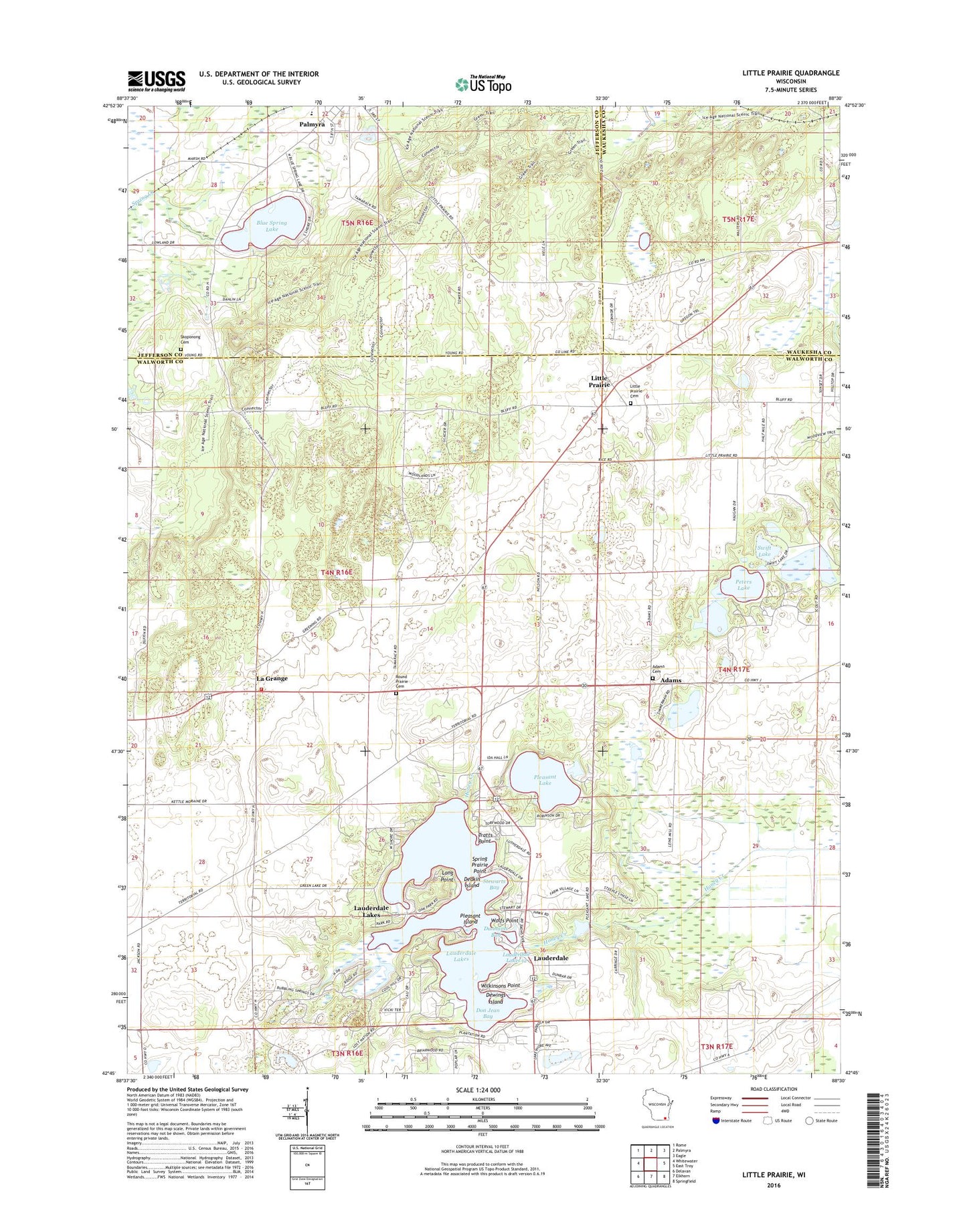
2022 topographic map quadrangle Little Prairie in the state of Wisconsin. Scale: 1:24000. Based on the newly updated USGS 7.5' US Topo map series, this map is in the following counties: Walworth, Jefferson, Waukesha. The map contains contour data, water features, and other items you are used to seeing on USGS maps, but also has updated roads and other features. This is the next generation of topographic maps. Printed on high-quality waterproof paper with UV fade-resistant inks.
Quads adjacent to this one:
West: Whitewater
Northwest: Rome
North: Palmyra
Northeast: Eagle
East: East Troy
Southeast: Springfield
South: Elkhorn
Southwest: Delavan
This map covers the same area as the classic USGS quad with code o42088g5.
Contains the following named places: Adams, Adams Cemetery, Battle Creek School, Blue Spring Lake, Blue Springs Lake 2WP1137 Dam, Cedar Grove Pond, Deakin Island, Dewings Island, Don Jean Bay, Dunhams Bay, Eagle Oak Opening State Natural Area, Ewings Landing, Green Lake, Hillside Cemetery, Kettle Moraine Oak Opening State Natural Area, La Grange, Lauderdale, Lauderdale - LaGrange Fire Department, Lauderdale Lakes, Lauderdale Lakes 12, Lauderdale Lakes 2-WP-618 Dam, Lauderdale Lakes Census Designated Place, Lauderdale Shores, Little Prairie, Little Prairie Cemetery, Long Point, Middle Lake, Mill Lake, Palmyra - Eagle Middle - High School, Palmyra - Eagle Middle School, Peters Lake, Pleasant Island, Pleasant Lake, Round Prairie Cemetery, Skoponong Cemetery, Sportsman Center, Spring Prairie Point, Stewarts Bay, Swift Lake, Tamarack Airport, Town of La Grange, Tratts Point, Wilkinsons Point, Wolfs Point