MyTopo
Stratford Wisconsin US Topo Map
Couldn't load pickup availability
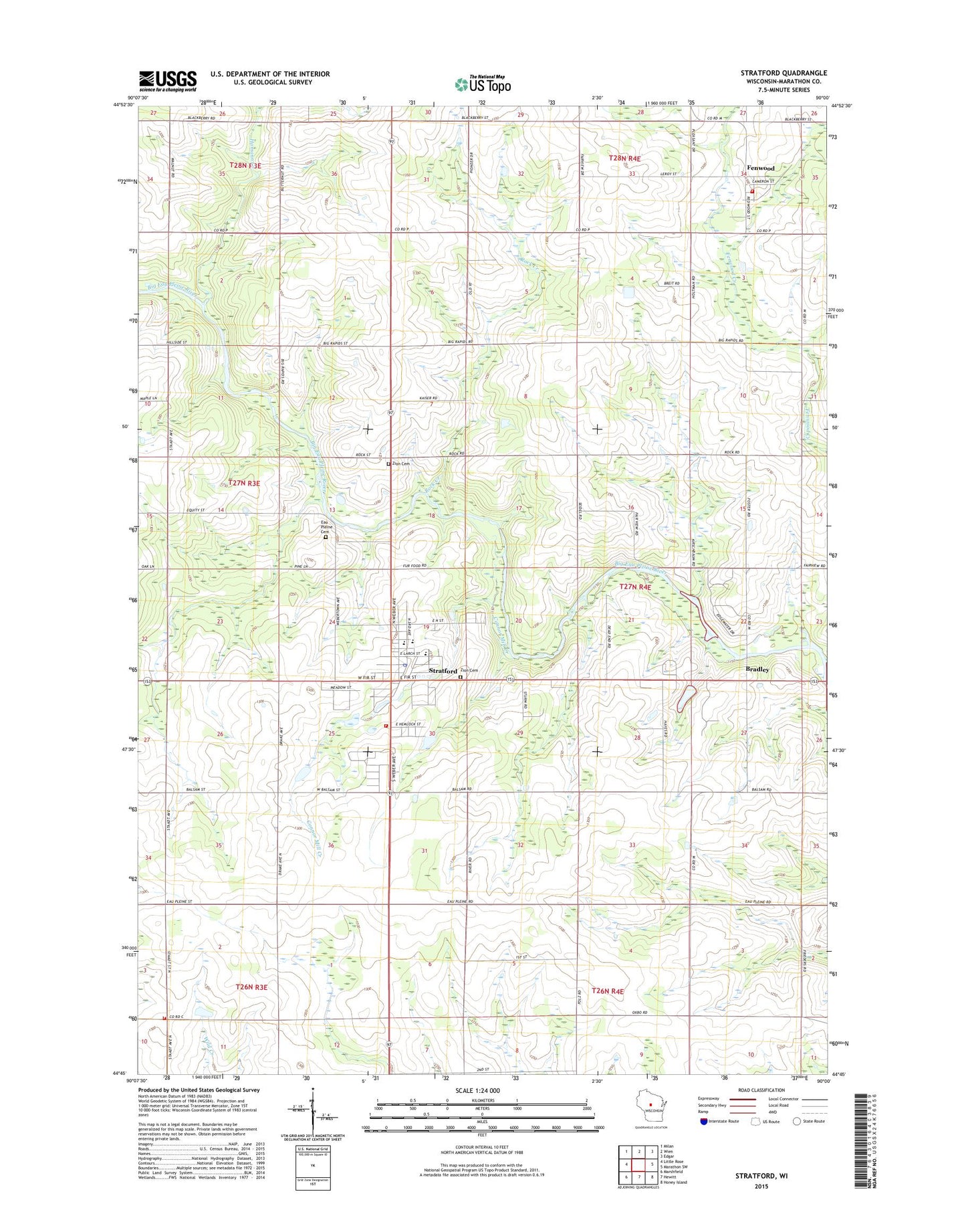
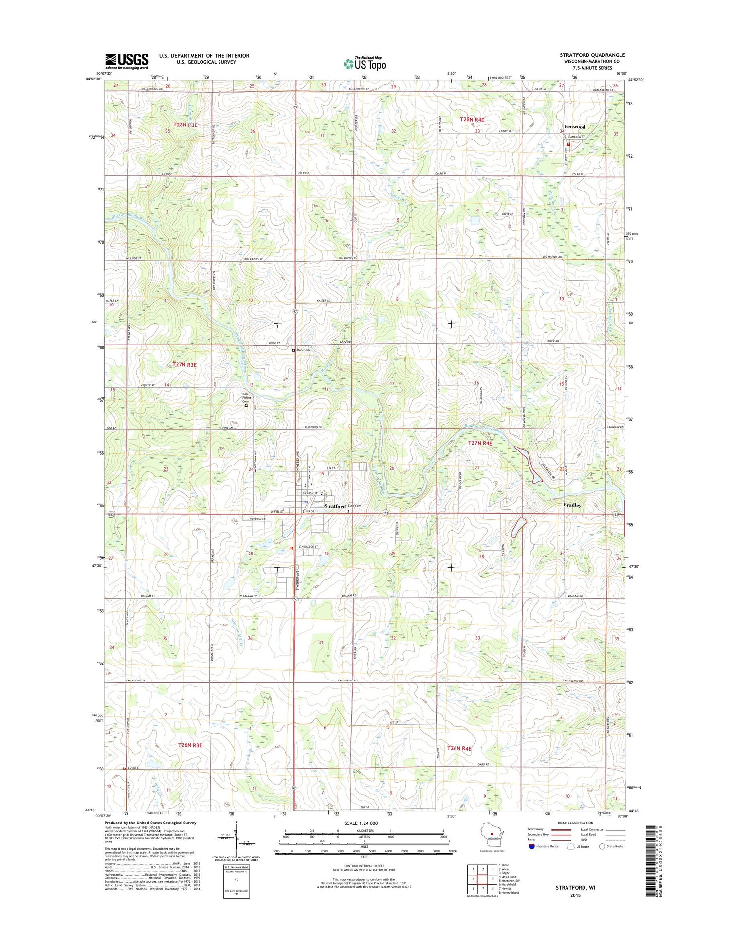
2018 topographic map quadrangle Stratford in the state of Wisconsin. Scale: 1:24000. Based on the newly updated USGS 7.5' US Topo map series, this map is in the following counties: Marathon. The map contains contour data, water features, and other items you are used to seeing on USGS maps, but also has updated roads and other features. This is the next generation of topographic maps. Printed on high-quality waterproof paper with UV fade-resistant inks.
Quads adjacent to this one:
West: Little Rose
Northwest: Milan
North: Wien
Northeast: Edgar
East: Marathon SW
Southeast: Honey Island
South: Hewitt
Southwest: Marshfield
Contains the following named places: 1 Reservoir, 54484, Arthur School, Balsam School, Big Rapids County Park, Bradley, Briggs School, Brock-Clint E7008 Dam, Connor Mill Creek, Drake School, East Kerwin School, Fairchild School, Fenwood, Grant School, Hamann Creek, Johnson School, Lloyd Keller E6861 Dam, Marathon County Public Library Stratford Branch, Marathon Pride School, Noisy Creek, Rock Creek, Saint Joseph Catholic Cemetery, Saint Joseph Catholic School, Saint Josephs Catholic Church, Saint Pauls Church, Staadts, Stratford, Stratford Area Fire Department Station 1, Stratford Area Fire Department Station 3, Stratford Area Fire Department Station 4, Stratford Elementary School, Stratford Junior Senior High School, Stratford Police Department, Stratford Post Office, Town of Cleveland, Village of Fenwood, Village of Stratford, Weber, Zion Cemetery, Zion Lutheran Cemetery