MyTopo
Milan Wisconsin US Topo Map
Couldn't load pickup availability
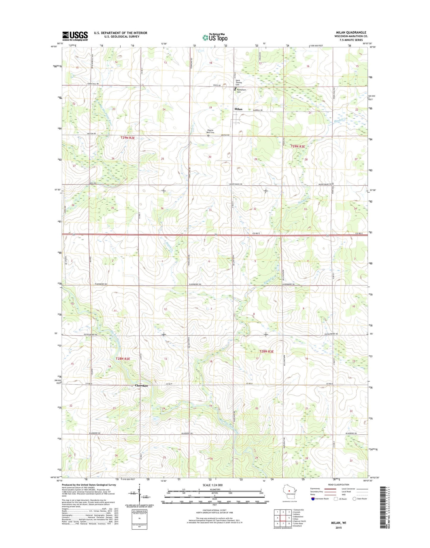
2022 topographic map quadrangle Milan in the state of Wisconsin. Scale: 1:24000. Based on the newly updated USGS 7.5' US Topo map series, this map is in the following counties: Marathon. The map contains contour data, water features, and other items you are used to seeing on USGS maps, but also has updated roads and other features. This is the next generation of topographic maps. Printed on high-quality waterproof paper with UV fade-resistant inks.
Quads adjacent to this one:
West: Abbotsford
Northwest: Stetsonville
North: Corinth
Northeast: Athens
East: Wien
Southeast: Stratford
South: Little Rose
Southwest: Spencer North
This map covers the same area as the classic USGS quad with code o44090h2.
Contains the following named places: Ann's Dairy, Bethlehem Lutheran Cemetery, Cherokee, Cherokee Park, Corinth Airport, Dixon School, East Branch Big Eau Pleine River, Enmar Dairy, Franklin School, Hidden Creek Ranch, Hillcrest School, Hoffman Farms, J M Dairy, Marsh Creek, Milan, Peace Church, Pilgrim Rest Cemetery, Ploeckelman Farms, Randall Creek, Rusk School, Saint Thomas Cemetery, Schreiber Acres, Town of Frankfort, Town of Johnson, Venzke Dairy, West Branch Big Eau Pleine River, Wright School