MyTopo
Little Rose Wisconsin US Topo Map
Couldn't load pickup availability
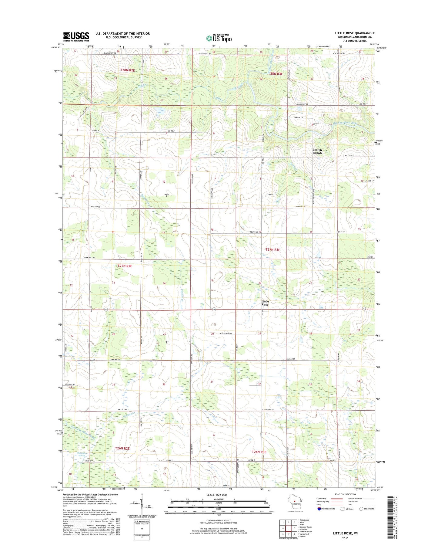
2022 topographic map quadrangle Little Rose in the state of Wisconsin. Scale: 1:24000. Based on the newly updated USGS 7.5' US Topo map series, this map is in the following counties: Marathon. The map contains contour data, water features, and other items you are used to seeing on USGS maps, but also has updated roads and other features. This is the next generation of topographic maps. Printed on high-quality waterproof paper with UV fade-resistant inks.
Quads adjacent to this one:
West: Spencer North
Northwest: Abbotsford
North: Milan
Northeast: Wien
East: Stratford
Southeast: Hewitt
South: Marshfield
Southwest: Spencer South
This map covers the same area as the classic USGS quad with code o44090g2.
Contains the following named places: 0.39 Reservoir, Carlson Creek, Del Fatti Construction Number 1 G-8737 Dam, Dill Creek, Emanuel Church, Enterprise School, Harding School, Kopp G 26 Dam, Lindbergh School, Little Rose, Lone Pine School, March Rapids, March Rapids County Park, McArthur School, Raeder Creek, Saint Adalbert Church, Timilin School, Town of Eau Pleine, Upham School, Wescott School, West Kerwin School