MyTopo
Mikana Wisconsin US Topo Map
Couldn't load pickup availability
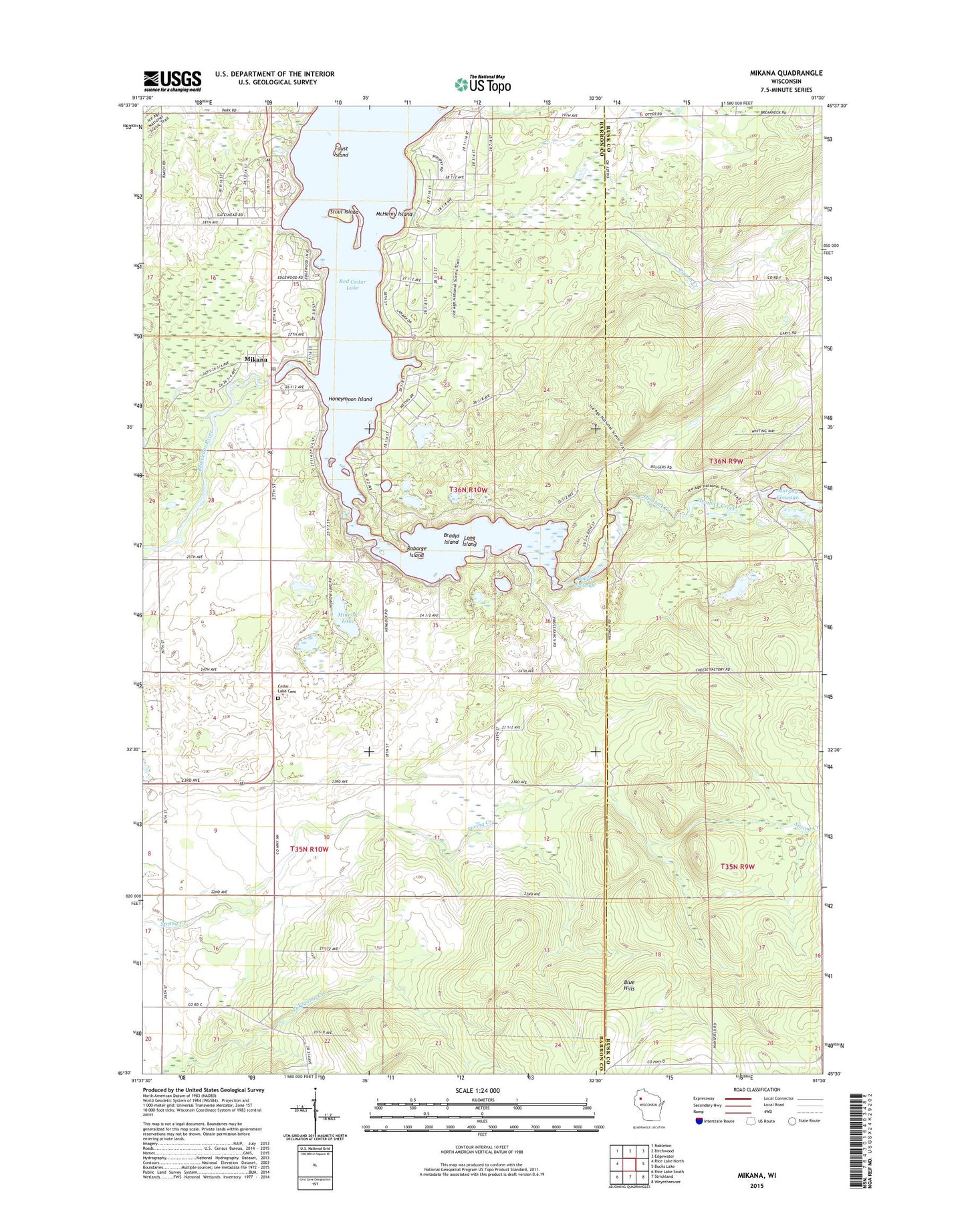
2022 topographic map quadrangle Mikana in the state of Wisconsin. Scale: 1:24000. Based on the newly updated USGS 7.5' US Topo map series, this map is in the following counties: Barron, Rusk. The map contains contour data, water features, and other items you are used to seeing on USGS maps, but also has updated roads and other features. This is the next generation of topographic maps. Printed on high-quality waterproof paper with UV fade-resistant inks.
Quads adjacent to this one:
West: Rice Lake North
Northwest: Nobleton
North: Birchwood
Northeast: Edgewater
East: Bucks Lake
Southeast: Weyerhaeuser
South: Strickland
Southwest: Rice Lake South
This map covers the same area as the classic USGS quad with code o45091e5.
Contains the following named places: Birchwood Lookout Tower, Bolger Dam, Bolger Flowage, Bradys Island, Cedar Lake Cemetery, Cedar Lake County Park, Cedar Lake Dam, Cedar Lake Town Hall, Doyle Townhall, Faust Island, Hemlock Creek, Hemlock Lake, Honeymoon Island, Immanuel Lutheran Church, Long Island, Loveland Corners, McHenry Island, Mikana, Mikana Post Office, Minnow Lake, Murphy Dam, Pigeon Creek, Red Cedar Lake, Robarge Island, Seck Memorial Park, Stout Island, Sucker Creek, Tag-a-long Airport, Town of Cedar Lake, Town of Doyle, Wilson Town Hall, ZIP Code: 54857