MyTopo
Thorp Wisconsin US Topo Map
Couldn't load pickup availability
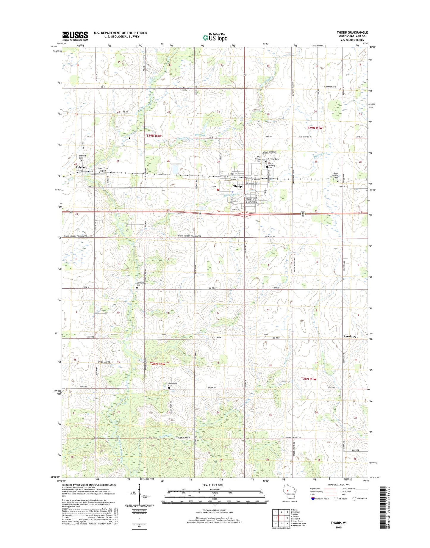
2018 topographic map quadrangle Thorp in the state of Wisconsin. Scale: 1:24000. Based on the newly updated USGS 7.5' US Topo map series, this map is in the following counties: Clark. The map contains contour data, water features, and other items you are used to seeing on USGS maps, but also has updated roads and other features. This is the next generation of topographic maps. Printed on high-quality waterproof paper with UV fade-resistant inks.
Quads adjacent to this one:
West: Stanley
Northwest: Huron
North: Bellinger
Northeast: Lublin
East: Lombard
Southeast: Mead Lake East
South: Mead Lake West
Southwest: Simes Creek
Contains the following named places: 0.234 Reservoir, 54771, Bi-Centennial School, Breezy Hill School, Bruce Mound Parochial School, Busy Bee School, City of Thorp, Conway Park, Dubicki Tobola E6009 Dam, East Cemetery, Eidsvold, Eidsvold Cemetery, Germanian Cemetery, Goff School, Goggle-Eye Creek, McGrogan Creek, North Fork Airport, Norwegian Cemetery, Pioneer School, Pleasant Valley Mennonite School, Reseburg, Saint Bernard Cemetery, Saint Hedwig New Cemetery, Saint Hedwig Old Cemetery, Saint Hedwig School, Saint Pauls Lutheran Church, Sterling Creek, Thorp, Thorp Area Fire District / Thorp Area Ambulance District, Thorp Catholic School, Thorp Elementary School, Thorp High School, Thorp Police Department, Thorp Post Office, Thorp Wastewater Treatment Facility, Town of Thorp, Town of Worden, Vern Air Park