MyTopo
Bellinger Wisconsin US Topo Map
Couldn't load pickup availability
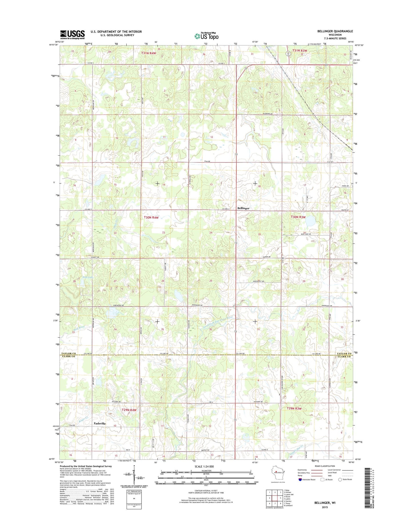
2022 topographic map quadrangle Bellinger in the state of Wisconsin. Scale: 1:24000. Based on the newly updated USGS 7.5' US Topo map series, this map is in the following counties: Taylor, Clark. The map contains contour data, water features, and other items you are used to seeing on USGS maps, but also has updated roads and other features. This is the next generation of topographic maps. Printed on high-quality waterproof paper with UV fade-resistant inks.
Quads adjacent to this one:
West: Huron
Northwest: Ruby
North: Gilman
Northeast: Lublin NW
East: Lublin
Southeast: Lombard
South: Thorp
Southwest: Stanley
This map covers the same area as the classic USGS quad with code o45090a7.
Contains the following named places: 1 Reservoir, Bellinger, Bellinger School, Burzynski E 5088.1 Dam, Eadsville, Euclide Wildlife Pond G1464 Dam, Field School, Mud Lake, Propst Flowage, Propst G1976 Dam, Raciborski G-5366 Dam, Red Brick School, Rosemeyer G-9498 Dam, Thorp Mennonite School, Town of Taft, Ukrainian Orthodox Church, Westland School, Yaeger School