MyTopo
Three Lakes Wisconsin US Topo Map
Couldn't load pickup availability
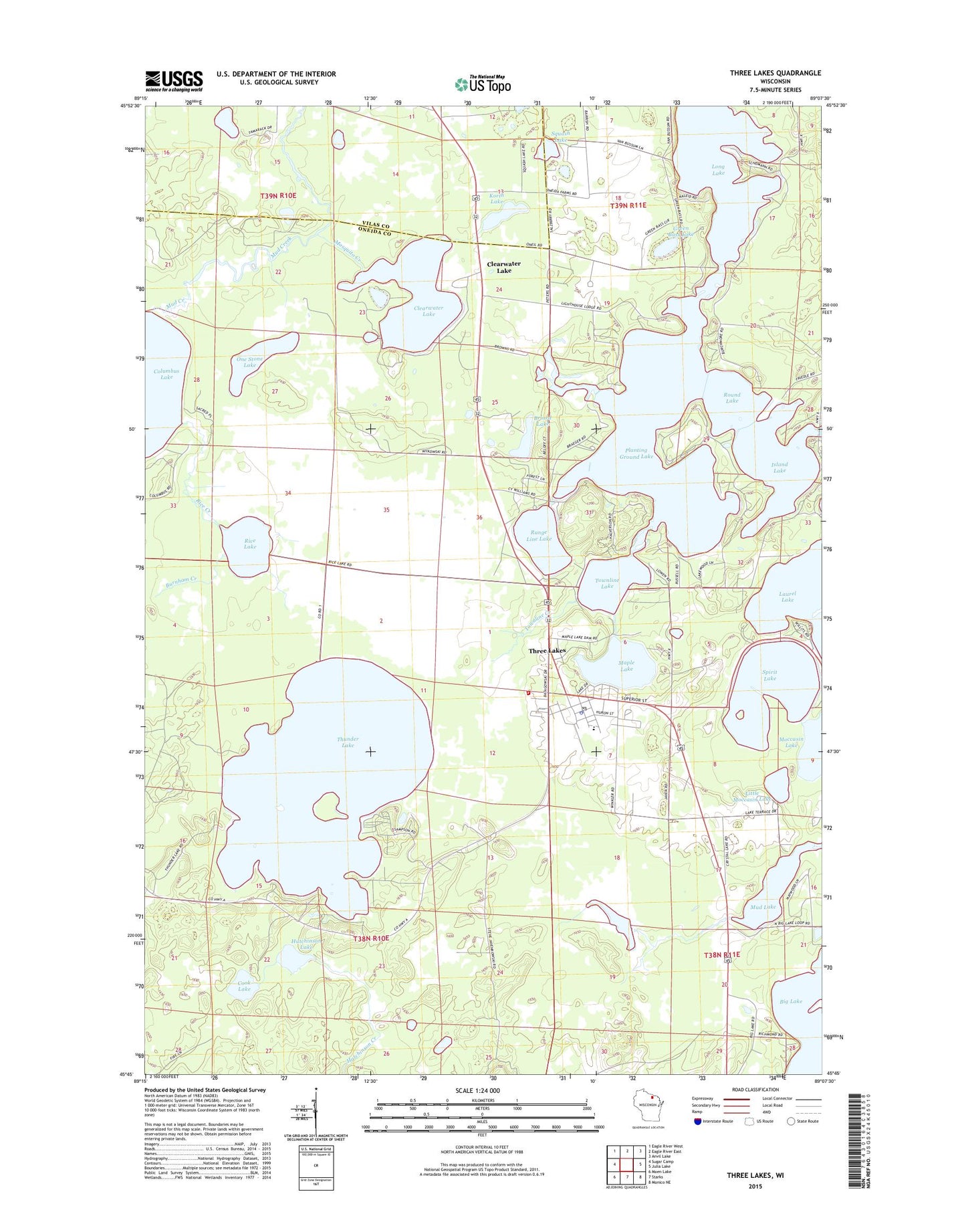
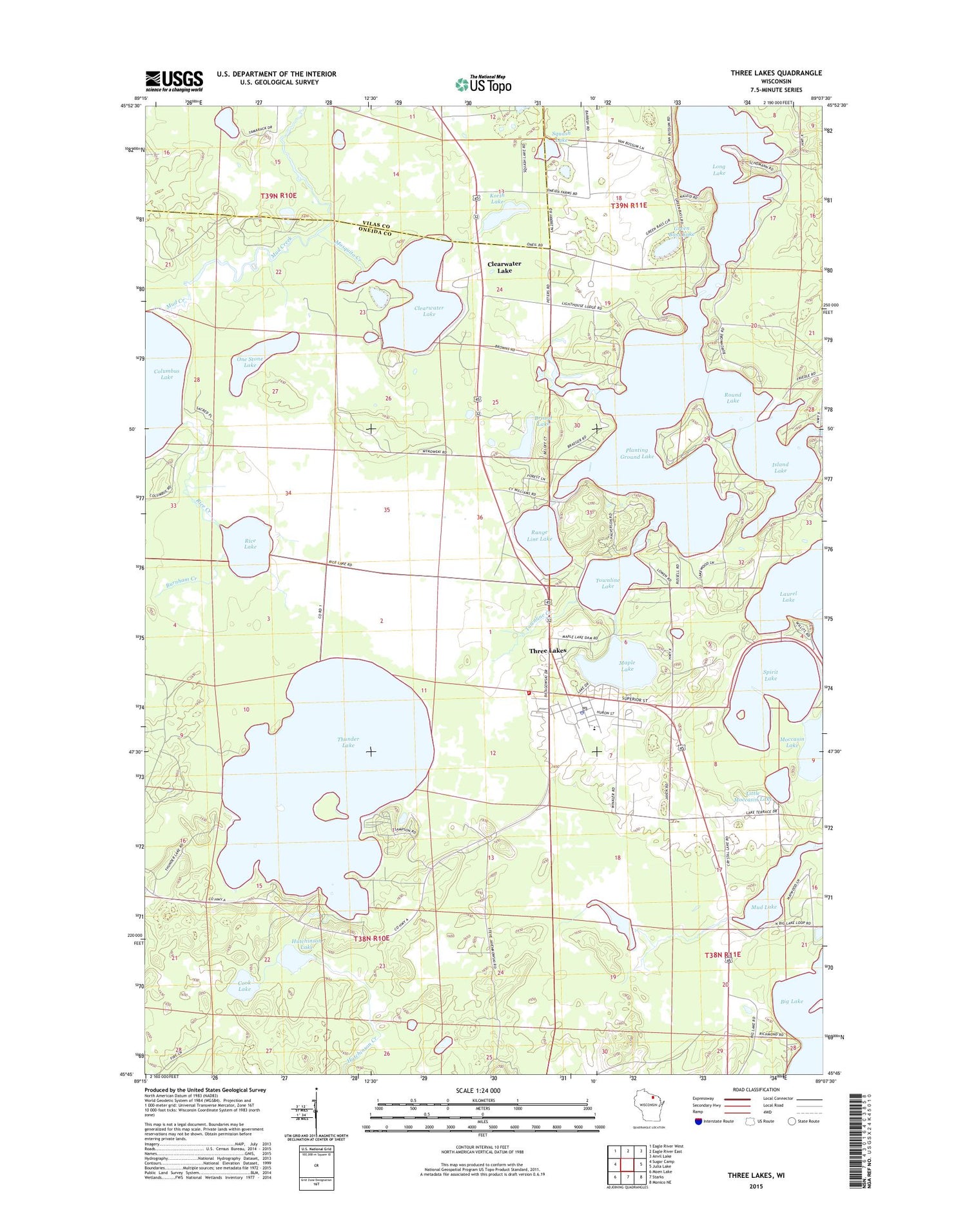
2018 topographic map quadrangle Three Lakes in the state of Wisconsin. Scale: 1:24000. Based on the newly updated USGS 7.5' US Topo map series, this map is in the following counties: Oneida, Vilas. The map contains contour data, water features, and other items you are used to seeing on USGS maps, but also has updated roads and other features. This is the next generation of topographic maps. Printed on high-quality waterproof paper with UV fade-resistant inks.
Quads adjacent to this one:
West: Sugar Camp
Northwest: Eagle River West
North: Eagle River East
Northeast: Anvil Lake
East: Julia Lake
Southeast: Monico NE
South: Starks
Southwest: Moen Lake
Contains the following named places: Briard Lake, Burnham Creek, Clearwater Lake, Cook Lake, Green Bass Lake, Hutchinson Lake, Island Lake, Korth Lake, Little Moccasin Lake, Long Lake, Maple Lake, Maple Lake 1, Maple Lake 2WP487 Dam, Medicine Lake, Moccasin Lake, Mosquito Creek, Mud Lake, One Stone Lake, Oneida County Ambulance Three Lakes Unit, Planting Ground Lake, Range Line Lake, Rice Creek, Rice Lake, Rice Lake State Natural Area, Round Lake, Sampson Cranberry Marsh, Seventh Day Adventist Church, Spirit Lake, Squash Lake, Three Lakes, Three Lakes Census Designated Place, Three Lakes Elementary School, Three Lakes Fire Department, Three Lakes Junior / Senior High School, Three Lakes Police Department, Three Lakes Post Office, Thunder Lake, Thunder Lake State Wildlife Area, Town of Three Lakes, Townline Creek, Townline Lake, WXPR-FM (Rhinelander)