MyTopo
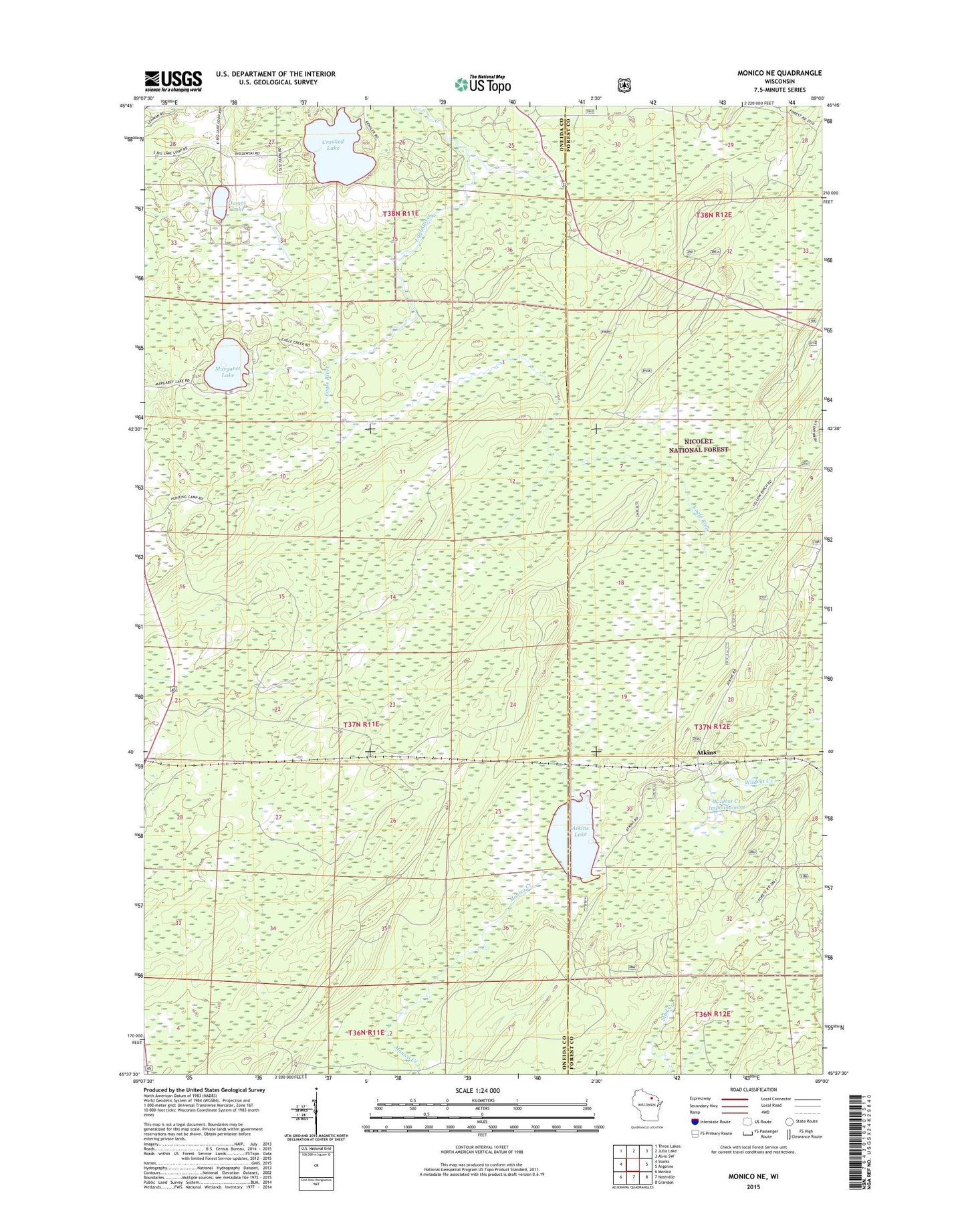
Monico NE Wisconsin US Topo Map
Couldn't load pickup availability
Also explore the Monico NE Forest Service Topo of this same quad for updated USFS data
2022 topographic map quadrangle Monico NE in the state of Wisconsin. Scale: 1:24000. Based on the newly updated USGS 7.5' US Topo map series, this map is in the following counties: Oneida, Forest. The map contains contour data, water features, and other items you are used to seeing on USGS maps, but also has updated roads and other features. This is the next generation of topographic maps. Printed on high-quality waterproof paper with UV fade-resistant inks.
Quads adjacent to this one:
West: Starks
Northwest: Three Lakes
North: Julia Lake
Northeast: Alvin SW
East: Argonne
Southeast: Crandon
South: Nashville
Southwest: Monico
This map covers the same area as the classic USGS quad with code o45089f1.
Contains the following named places: Atkins, Atkins Lake, Atkins Lake State Natural Area, Browns Landing, Crooked Lake, James Lake, James Lake Farms, Margaret Lake, Nelson Landing, Spur Number 234, Spur Number 236, Town of Piehl, Wildcat Creek Impoundment, Yellow Birch Landing