MyTopo
Eagle River West Wisconsin US Topo Map
Couldn't load pickup availability
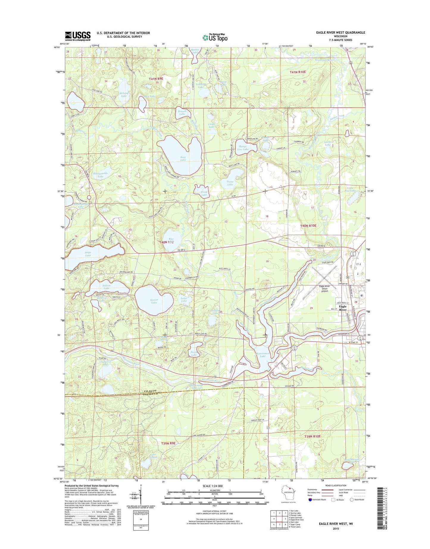
2022 topographic map quadrangle Eagle River West in the state of Wisconsin. Scale: 1:24000. Based on the newly updated USGS 7.5' US Topo map series, this map is in the following counties: Vilas, Oneida. The map contains contour data, water features, and other items you are used to seeing on USGS maps, but also has updated roads and other features. This is the next generation of topographic maps. Printed on high-quality waterproof paper with UV fade-resistant inks.
Quads adjacent to this one:
West: Saint Germain
Northwest: Star Lake
North: Stormy Lake
Northeast: Pioneer Lake
East: Eagle River East
Southeast: Three Lakes
South: Sugar Camp
Southwest: Dam Lake
This map covers the same area as the classic USGS quad with code o45089h3.
Contains the following named places: Adams Lake, Ascension Eagle River Memorial Hospital, Bohemian School, Boot Creek, Boot Lake, Boot Lake School, Brazell Creek, Brazell Lake, Bullfrog Lake, Chickaree Lake, City of Eagle River, Cooks Lake, Crocker School, Croker Lake, Deep Lake, Eagle River, Eagle River Elementary School, Eagle River Union Airport, Eagle River Village Hall, Frost Lake, Honeysuckle Lake, Lake Aidenn, Lake Mary, Little Pine Lake, Lotus Lake, McLeod Lake, Mud Creek, Mud Lake, Mud Minnow Lake, Muskellunge School, Nelson Lake, Northland Pines High School, Otter Rapids 1905c483 Dam, Otter Rapids Dam, Otter Rapids Golf Course, Perch Lake, Perch Lake School, Pickerel Creek, Range Line Lake, Rice Creek, Rice Lake, Seneca Lake, Snipe Lake, SOAR Charter High School, Sucker Creek, Sunset Lake, Tellefson Lake, Tepee Lake, Town of Cloverland, Travel Care International Ambulance Service, Vilas County Courthouse, Vilas County Sheriff's Office, Walter E Olson Memorial Library, Watersmeet Lake, Watersmeet Lake 533, ZIP Code: 54521