MyTopo
Upson Wisconsin US Topo Map
Couldn't load pickup availability
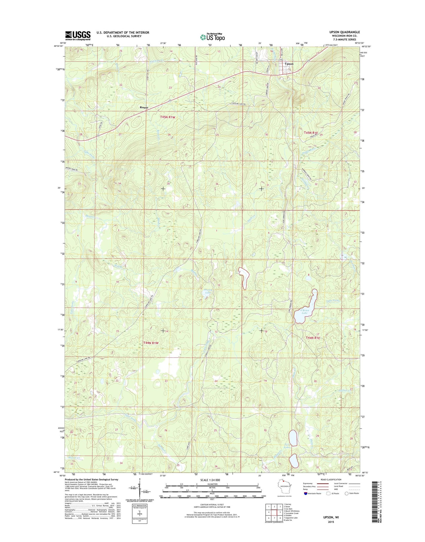
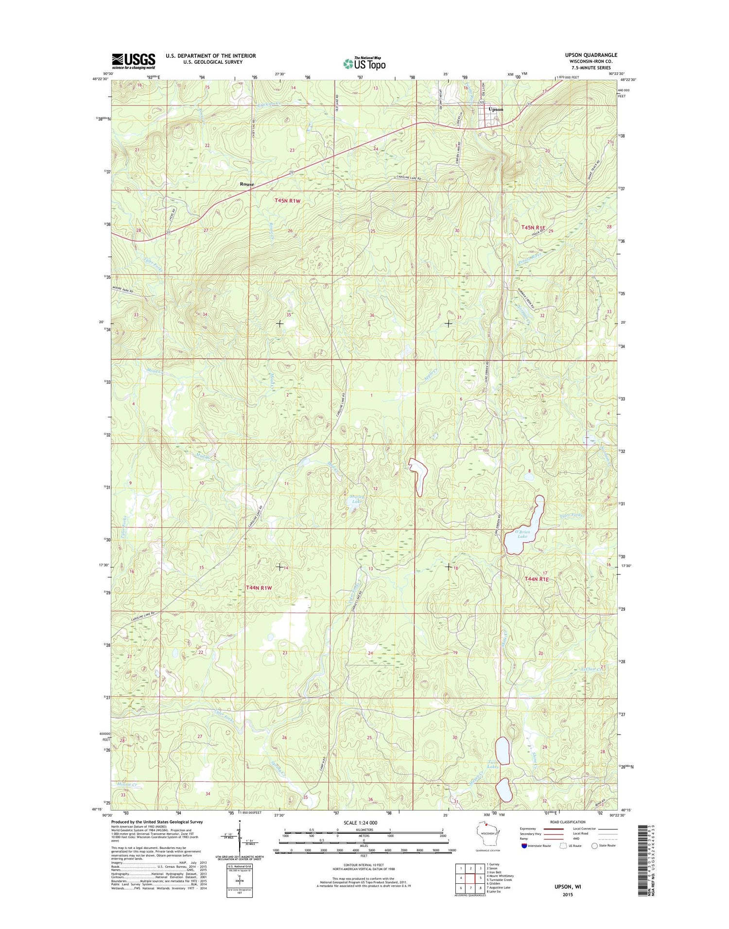
2018 topographic map quadrangle Upson in the state of Wisconsin. Scale: 1:24000. Based on the newly updated USGS 7.5' US Topo map series, this map is in the following counties: Iron. The map contains contour data, water features, and other items you are used to seeing on USGS maps, but also has updated roads and other features. This is the next generation of topographic maps. Printed on high-quality waterproof paper with UV fade-resistant inks.
Quads adjacent to this one:
West: Mount Whittlesey
Northwest: Gurney
North: Saxon
Northeast: Iron Belt
East: Turntable Creek
Southeast: Lake Six
South: Augustine Lake
Southwest: Glidden
Contains the following named places: Apple Creek, Bull Gus Creek, Erickson Creek, Le Claire Camp, LeClair Creek, McIver Camp, Mead Creek, Mud Creek, Norman Creek, O'Brien Lake, Rouse, Rouse Creek, Shine Creek, Shirley Lake, Spring Creek, Town of Anderson, Twin Lakes, Upson, ZIP Code: 54565