MyTopo
Glidden Wisconsin US Topo Map
Couldn't load pickup availability
Also explore the Glidden Forest Service Topo of this same quad for updated USFS data
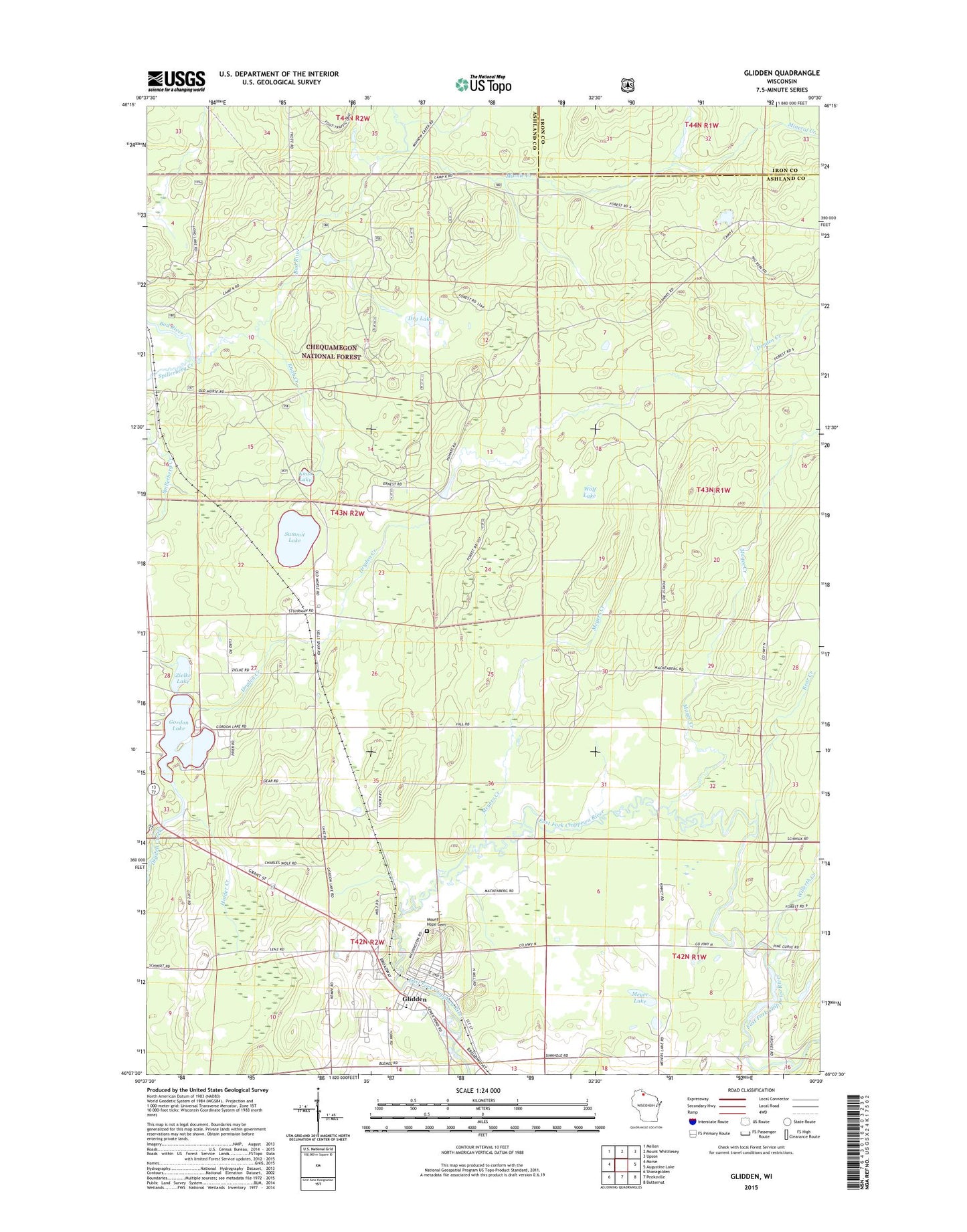
2022 topographic map quadrangle Glidden in the state of Wisconsin. Scale: 1:24000. Based on the newly updated USGS 7.5' US Topo map series, this map is in the following counties: Ashland, Iron. The map contains contour data, water features, and other items you are used to seeing on USGS maps, but also has updated roads and other features. This is the next generation of topographic maps. Printed on high-quality waterproof paper with UV fade-resistant inks.
Quads adjacent to this one:
West: Morse
Northwest: Mellen
North: Mount Whittlesey
Northeast: Upson
East: Augustine Lake
Southeast: Butternut
South: Peeksville
Southwest: Shanagolden
This map covers the same area as the classic USGS quad with code o46090b5.
Contains the following named places: Bear Creek, Chequamegon North Campus, Ditmans Lake, Dry Lake, Glidden, Glidden Area Emergency Medical Service, Glidden Census Designated Place, Glidden Post Office, Gordon Lake, Great Divide Wayside Park, Hinder Creek, Knab Creek, Knab Lake, Magee Creek, Marian Park, Meyer Lake, Meyers Creek, Mineral Creek, Minnie Creek, Mount Hope Cemetery, Park Falls Elementary School, Sells Lake, Spillerberg Creek, Summit Lake, Town of Jacobs, Trout Lake, Willerth Creek, Wolf Lake, Zielke Lake