MyTopo
Edgewater Wisconsin US Topo Map
Couldn't load pickup availability
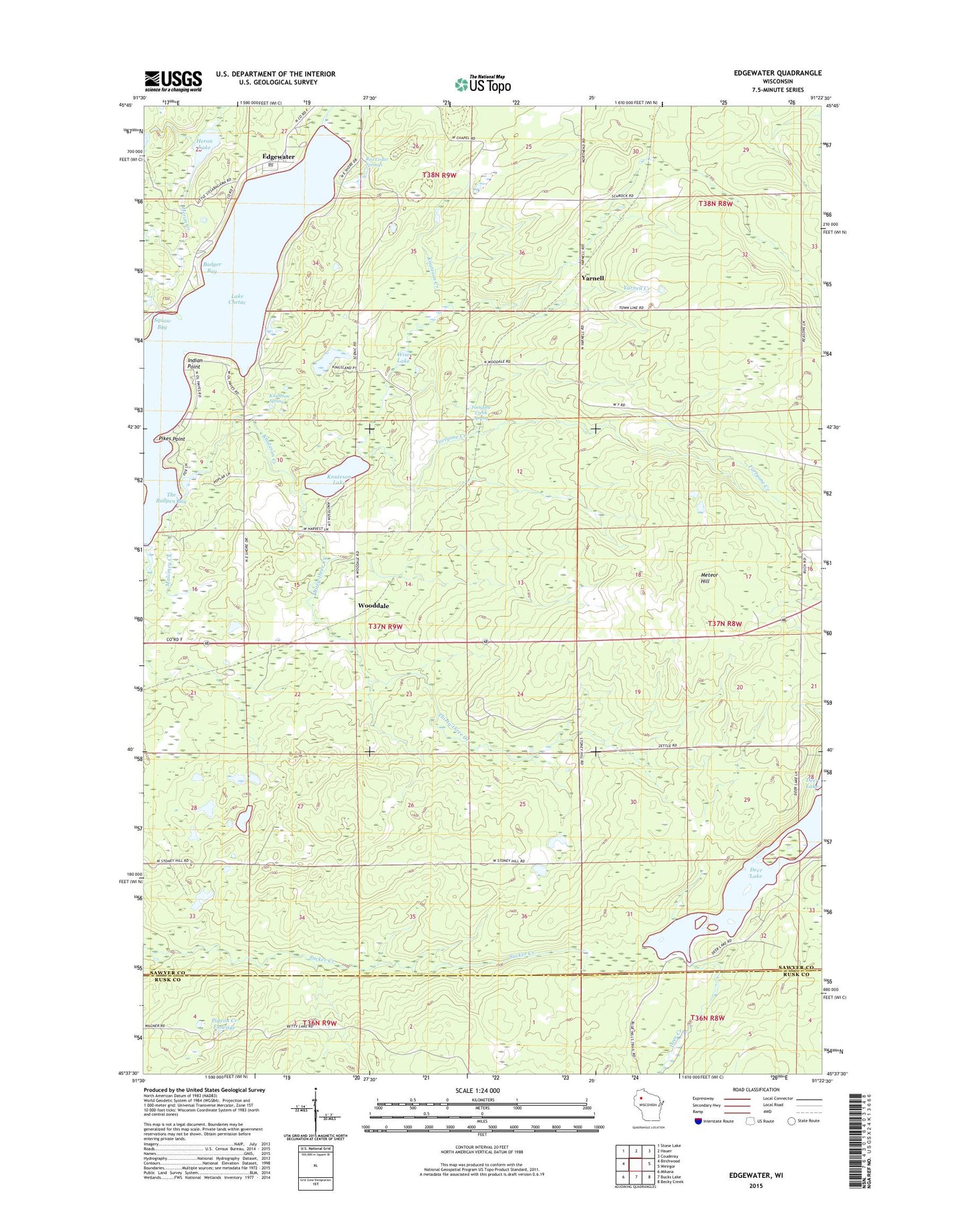
2023 topographic map quadrangle Edgewater in the state of Wisconsin. Scale: 1:24000. Based on the newly updated USGS 7.5' US Topo map series, this map is in the following counties: Sawyer, Rusk. The map contains contour data, water features, and other items you are used to seeing on USGS maps, but also has updated roads and other features. This is the next generation of topographic maps. Printed on high-quality waterproof paper with UV fade-resistant inks.
Quads adjacent to this one:
West: Birchwood
Northwest: Stone Lake
North: Hauer
Northeast: Couderay
East: Weirgor
Southeast: Becky Creek
South: Bucks Lake
Southwest: Mikana
This map covers the same area as the classic USGS quad with code o45091f4.
Contains the following named places: Badger Bay, Benson Creek, Deer Creek 2WP1328 Dam, Deer Lake, Deer Lake 10, Edgewater, Edgewater Post Office, Edgewater Town Hall, Fortyone Creek, Fortyone Creek Spring, Heron Creek, Heron Lake, Indian Point, Knuteson Creek, Knuteson Lake, Knuteson Spring, Lake Chetac, Malviney Creek, Meteor Hill, Pigeon Creek Flowage, Pigeon Creek Flowage G129 Dam, Pikes Point, Red Cedar Springs, Squaw Bay, The Bullpen Bay, The Narrows, Thirty-three Creek, Town of Edgewater, Wise Lake, Wooddale, Yarnell, Yarnell Creek