MyTopo
Couderay Wisconsin US Topo Map
Couldn't load pickup availability
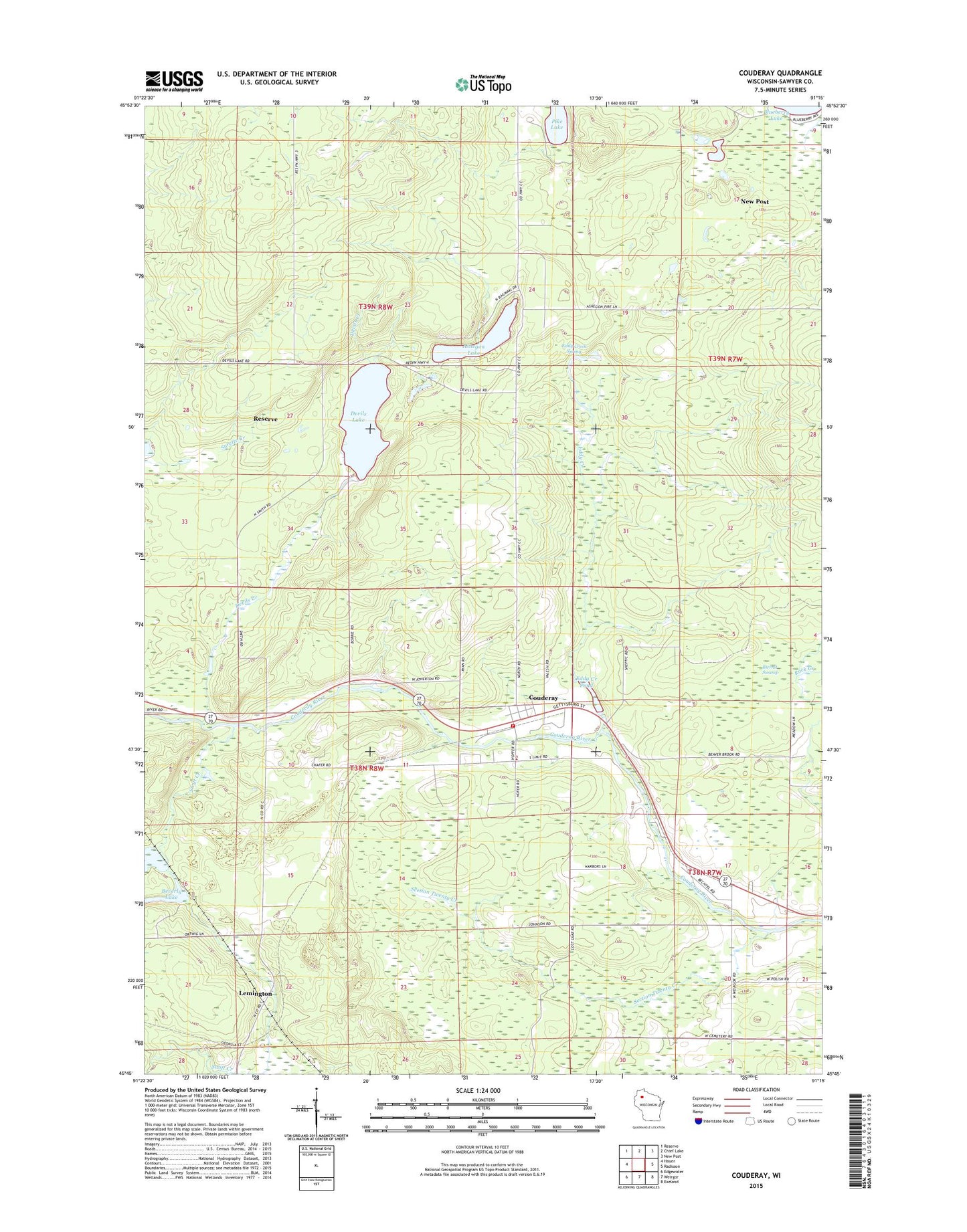
2022 topographic map quadrangle Couderay in the state of Wisconsin. Scale: 1:24000. Based on the newly updated USGS 7.5' US Topo map series, this map is in the following counties: Sawyer. The map contains contour data, water features, and other items you are used to seeing on USGS maps, but also has updated roads and other features. This is the next generation of topographic maps. Printed on high-quality waterproof paper with UV fade-resistant inks.
Quads adjacent to this one:
West: Hauer
Northwest: Reserve
North: Chief Lake
Northeast: New Post
East: Radisson
Southeast: Exeland
South: Weirgor
Southwest: Edgewater
This map covers the same area as the classic USGS quad with code o45091g3.
Contains the following named places: Ashegon Lake, Beverly Lake, Beverly Lake State Wildlife Management Area, Biernit Swamp, Couderay, Couderay Volunteer Fire Department, Devils Creek, Devils Lake, Eddy Creek, Eddy Creek Pond, Eddy Creek Spring, Eddy Creek State Wildlife Management Area, Lemington, Pike Lake, Reserve Census Designated Place, Sacred Heart Church, Section Twenty Creek, Swift Creek, Town of Couderay, Village of Couderay, WOJB-FM (Reserve), ZIP Code: 54828