MyTopo
White Potato Lake Wisconsin US Topo Map
Couldn't load pickup availability
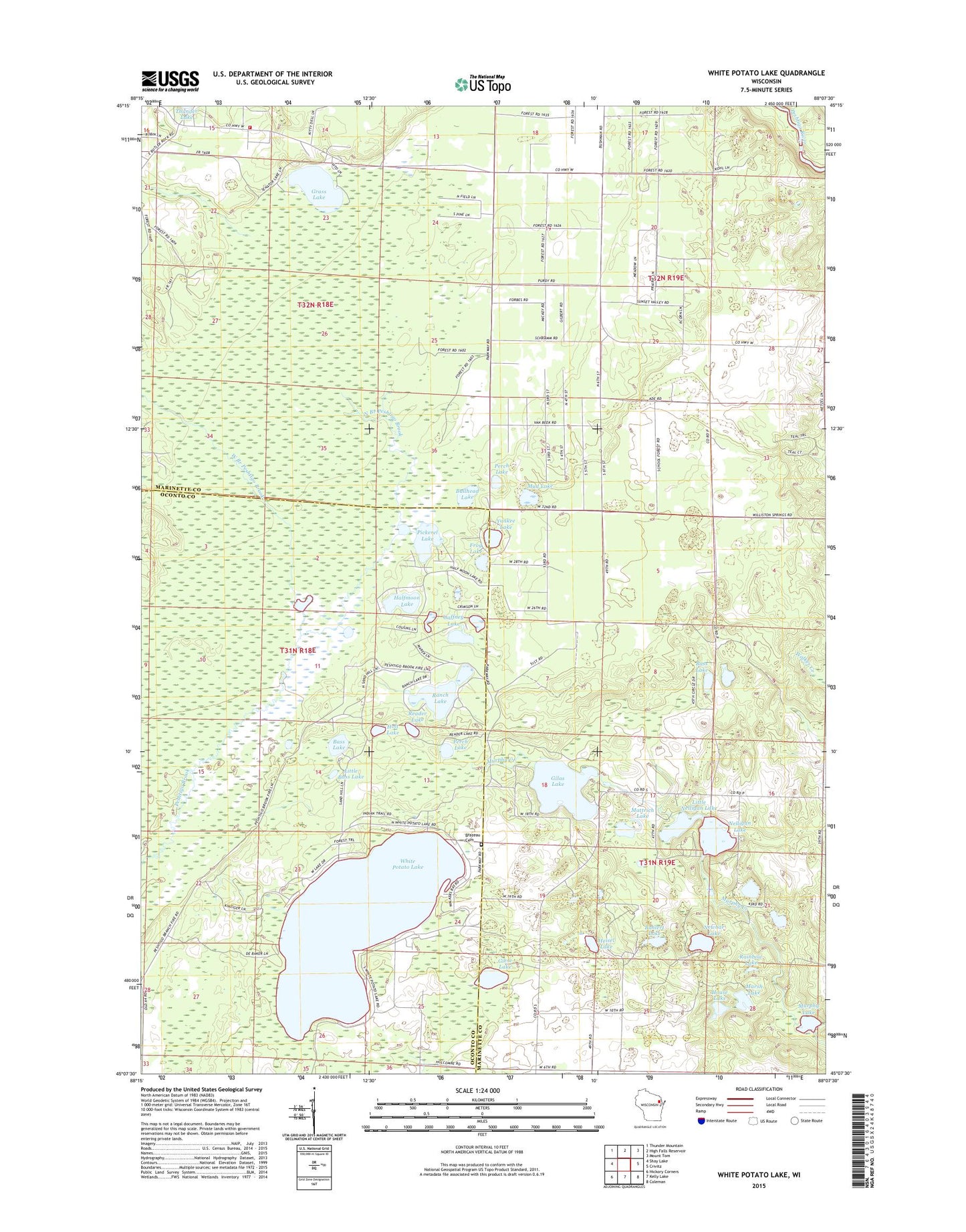
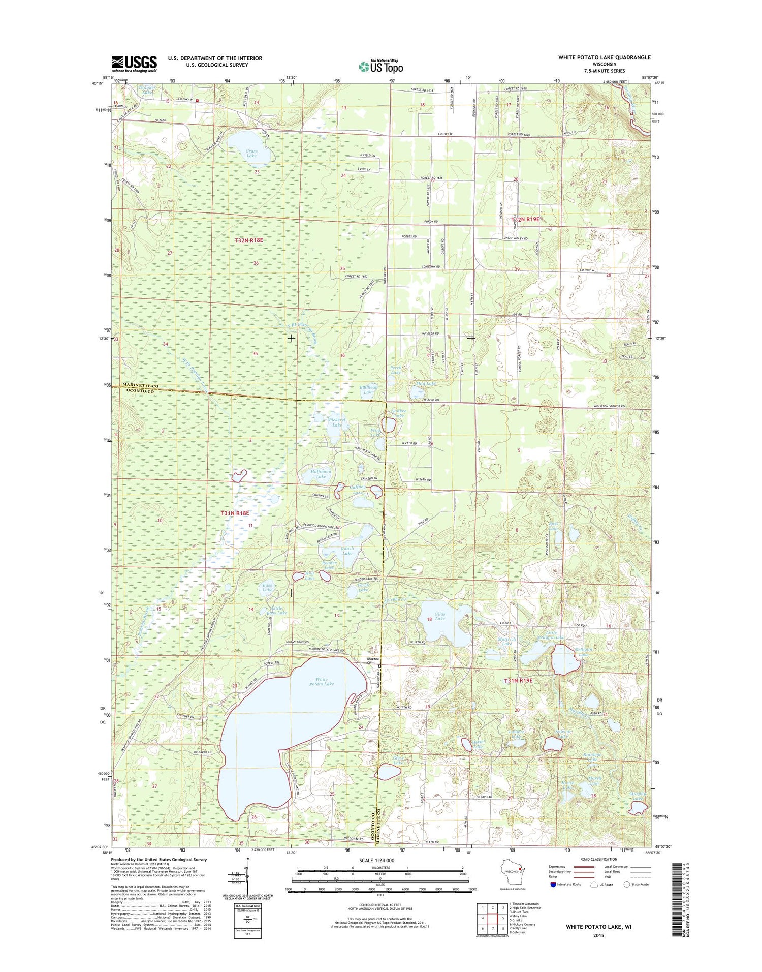
2018 topographic map quadrangle White Potato Lake in the state of Wisconsin. Scale: 1:24000. Based on the newly updated USGS 7.5' US Topo map series, this map is in the following counties: Marinette, Oconto. The map contains contour data, water features, and other items you are used to seeing on USGS maps, but also has updated roads and other features. This is the next generation of topographic maps. Printed on high-quality waterproof paper with UV fade-resistant inks.
Quads adjacent to this one:
West: Shay Lake
Northwest: Thunder Mountain
North: High Falls Reservoir
Northeast: Mount Tom
East: Crivitz
Southeast: Coleman
South: Kelly Lake
Southwest: Hickory Corners
Contains the following named places: Bahlert Lake, Bass Lake, Brazeau Cemetery, Bullhead Lake, Frog Lake, Gaffney Lake, Giese Lake, Gilas Lake, Grass Lake, Halfmoon Lake, Heisel Lake, Holt Lake, House Lake, Little Bass Lake, Little Nelligan Lake, Little Pickerel Lake, Marsh Lake, Marsh Lake Dam, Mattrich Lake, Mud Lake, Murphy Lake, Napper School, Nelligan Lake, Nelligan Lake 2WP2564 Dam, Newbar Lake, North Branch Peshtigo Brook, Patz Airport, Perch Lake, Pickerel Lake, Rainbow Lake, Ranch Lake, Reader Lake, Reeds Hill School, Stephenson Vounteer Fire Department - Thunder Lake Station, West Branch Peshtigo Brook, White Potato Lake, White Potato Lake School, Yankee Lake