
MyTopo
Winchester Wisconsin US Topo Map
Couldn't load pickup availability
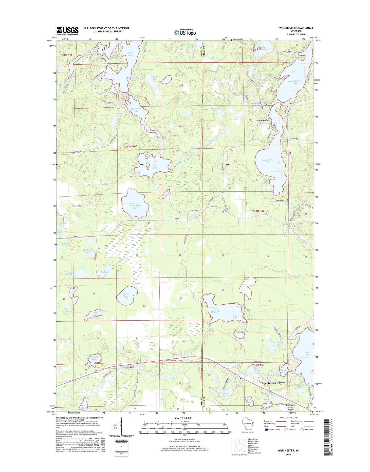
2018 topographic map quadrangle Winchester in the state of Wisconsin. Scale: 1:24000. Based on the newly updated USGS 7.5' US Topo map series, this map is in the following counties: Iron, Vilas. The map contains contour data, water features, and other items you are used to seeing on USGS maps, but also has updated roads and other features. This is the next generation of topographic maps. Printed on high-quality waterproof paper with UV fade-resistant inks.
Quads adjacent to this one:
West: Mercer
Northwest: Lake Evelyn
North: Chaney Lake
Northeast: Harris Lake
East: Papoose Lake
Southeast: Manitowish Lake
South: Powell
Southwest: Wilson Lake
Contains the following named places: Allen Lake, Beaver Lake, Belding Lake, Benson Lake, Brandt Lake, Catherine Lake, Cedar Lake, Chub Lake, Circle Lily Lake, Dog Lake, DuPage Lake, Fisher Lake, Gem Lake, Harvey Lake, Judd Lake, Kelly Lake, Lake Adelaide, Little Bass Lake, Manitowish Waters, Manitowish Waters Post Office, McCabe Lake, McKinney Lake, North Bass Lake, North Pine Lake, North Turtle Lake, Norway Pine Lake, Oriole Lake, Papoose Creek, Plunkett Lake, Rainbow Creek, Rest Stone Spider Mud Lakes, Rest Lake, Rest Lake 2WP295 Dam, Saskatoon Lake, Seven Acres Lake, Shay Dam, Shay Lake, South Bass Lake, South Turtle Lake, Statehouse Lake, Sturgeon Lake, Tamarack Lake, Toy Lake, Trap Lake, Twin Lakes, Vance Lake, Wallace Lake, Winchester, Winchester Fire Department, Woodson Lake


