
MyTopo
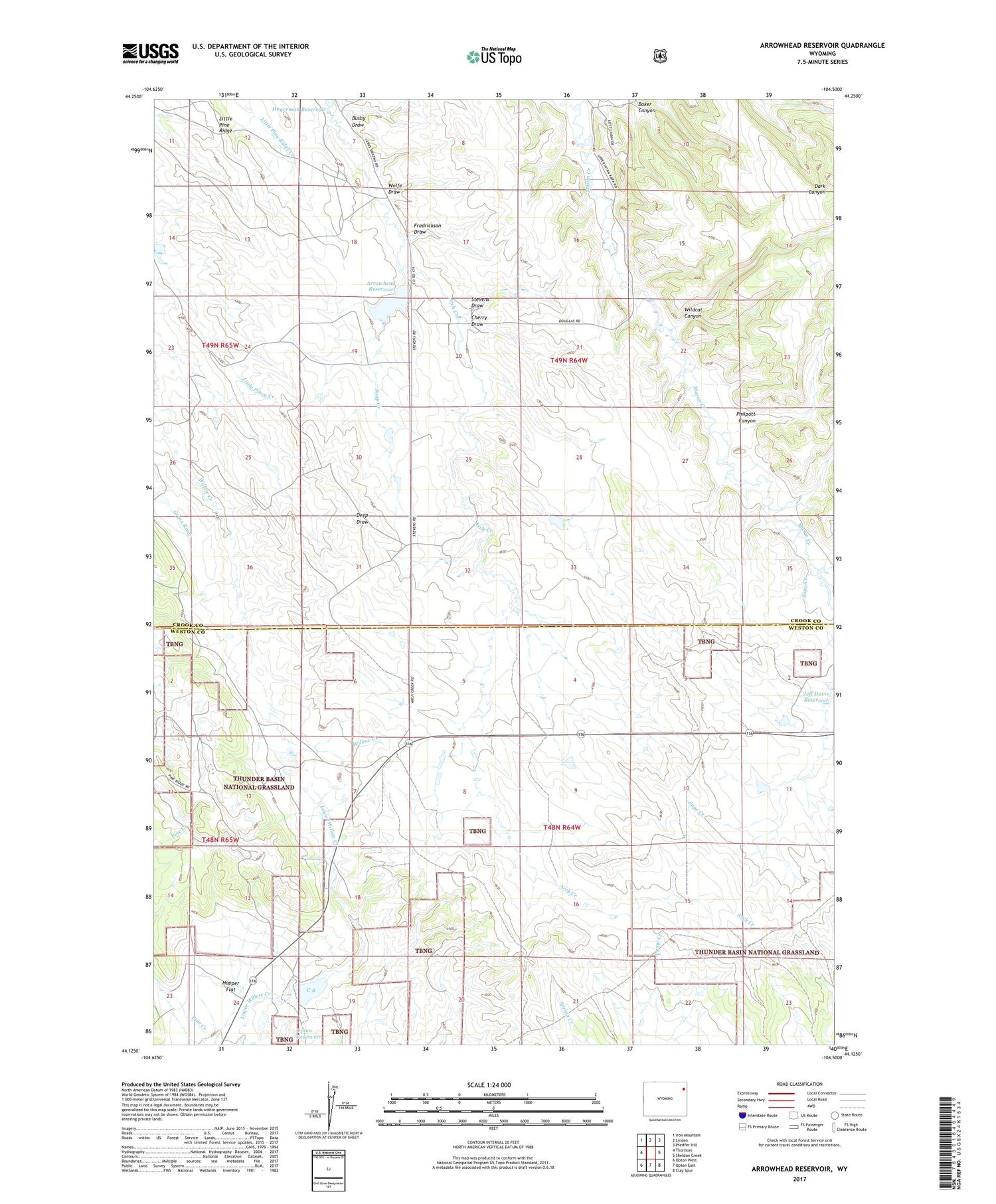
Arrowhead Reservoir Wyoming US Topo Map
Couldn't load pickup availability
2021 topographic map quadrangle Arrowhead Reservoir in the state of Wyoming. Scale: 1:24000. Based on the newly updated USGS 7.5' US Topo map series, this map is in the following counties: Crook, Weston. The map contains contour data, water features, and other items you are used to seeing on USGS maps, but also has updated roads and other features. This is the next generation of topographic maps. Printed on high-quality waterproof paper with UV fade-resistant inks.
Quads adjacent to this one:
West: Thornton
Northwest: Iron Mountain
North: Linden
Northeast: Pfeiffer Hill
East: Sheldon Creek
Southeast: Clay Spur
South: Upton East
Southwest: Upton West
Contains the following named places: Arrohead Dam, Arrowhead Reservoir, Baker Canyon, Busby Draw, C B, Cherry Draw, Deep Draw, Fredrickson Draw, Hopper Flat, Little Pine Ridge, Mason Creek, Philpott Canyon, Pine Ridge, Sage Creek, Soap Creek, Stevens Draw, Upton Bentonite Mine, Upton Dam, Upton Reservoir, Wildcat Canyon, Wolfe Draw


