MyTopo
Upton West Wyoming US Topo Map
Couldn't load pickup availability
Also explore the Upton West Forest Service Topo of this same quad for updated USFS data
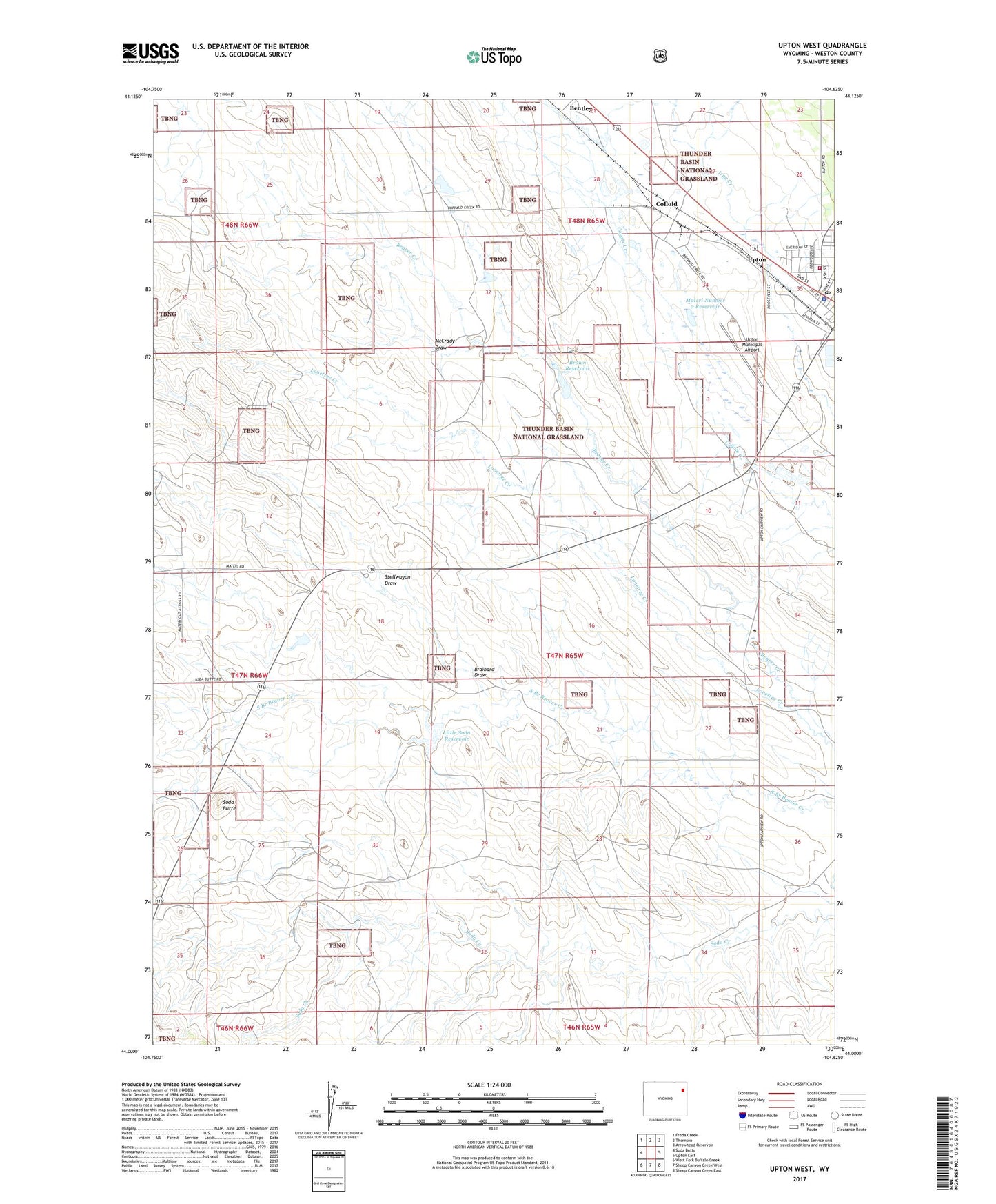
2021 topographic map quadrangle Upton West in the state of Wyoming. Scale: 1:24000. Based on the newly updated USGS 7.5' US Topo map series, this map is in the following counties: Weston. The map contains contour data, water features, and other items you are used to seeing on USGS maps, but also has updated roads and other features. This is the next generation of topographic maps. Printed on high-quality waterproof paper with UV fade-resistant inks.
Quads adjacent to this one:
West: Soda Butte
Northwest: Freda Creek
North: Thornton
Northeast: Arrowhead Reservoir
East: Upton East
Southeast: Sheep Canyon Creek East
South: Sheep Canyon Creek West
Southwest: West Fork Buffalo Creek
This map covers the same area as the classic USGS quad with code o44104a6.
Contains the following named places: Airport Shale Pit Mine, Barton Ranch, Bentley, Brainard Draw, Brainerd Dam, Brainerd Reservoir, Brown Comm 9-497-2 Reservoir, Brown Reservoir, Colloid, Huff Dam, Huff Reservoir, Little Soda Dam, Little Soda Reservoir, Lonetree Creek, Materi Number 2 Dam, Materi Number 2 Reservoir, Materi Ranch, McCrady Draw, Norris Ranch, SCS Beaver Creek Dam, Shannon Ranch, Soda Butte, Stellwagon Draw, Thornton Dome Mine, Town of Upton, Twin Forks Reservoir, Upton, Upton High School, Upton Middle School, Upton Municipal Airport, Upton Outdoor Lab Site Number 4 Dam, Upton Outdoor Lab Site Number 4 Reservoir, Upton Police Department, Upton Post Office, Upton School, Upton Volunteer Fire Department, ZIP Code: 82730