MyTopo
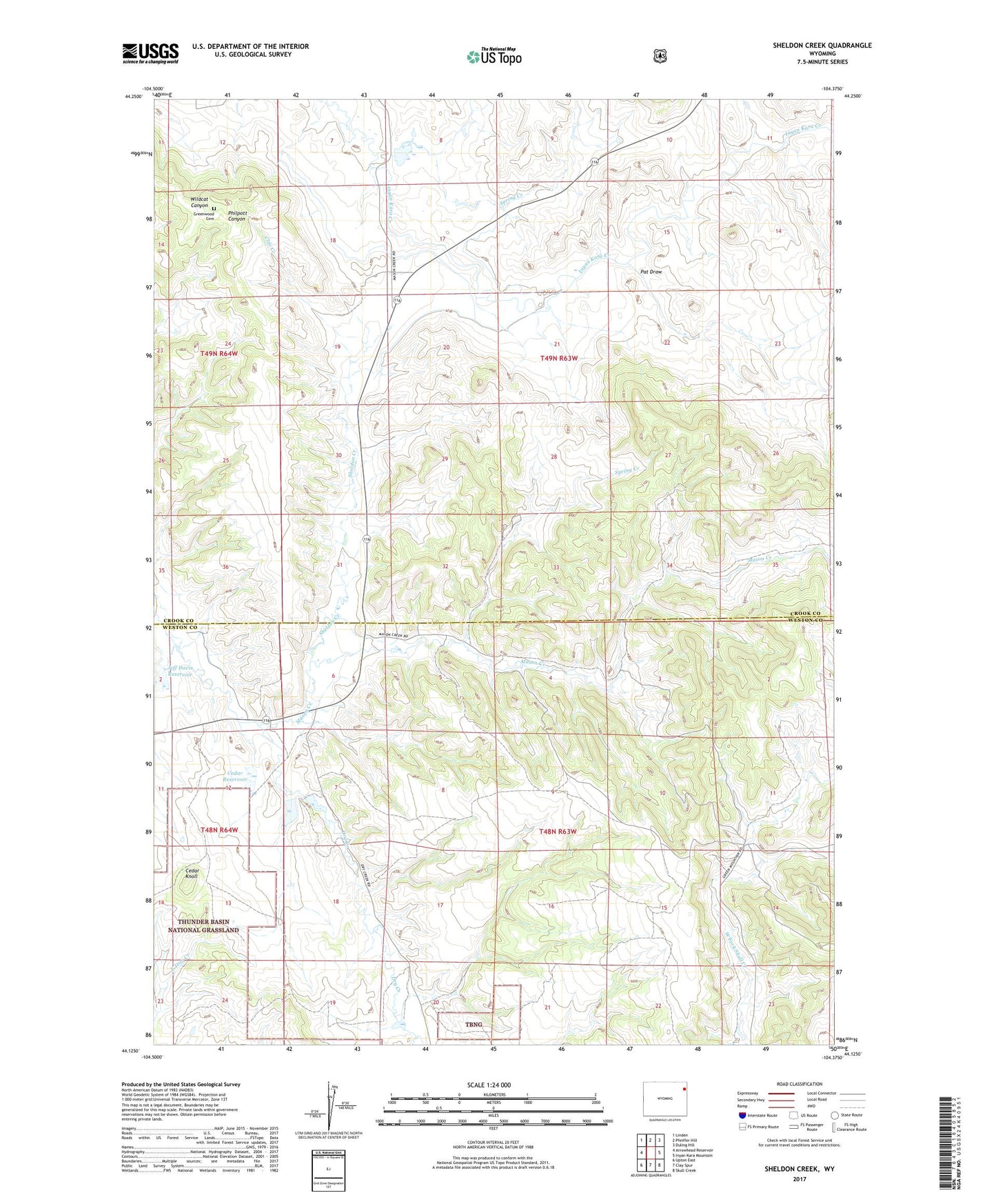
Sheldon Creek Wyoming US Topo Map
Couldn't load pickup availability
Also explore the Sheldon Creek Forest Service Topo of this same quad for updated USFS data
2021 topographic map quadrangle Sheldon Creek in the state of Wyoming. Scale: 1:24000. Based on the newly updated USGS 7.5' US Topo map series, this map is in the following counties: Crook, Weston. The map contains contour data, water features, and other items you are used to seeing on USGS maps, but also has updated roads and other features. This is the next generation of topographic maps. Printed on high-quality waterproof paper with UV fade-resistant inks.
Quads adjacent to this one:
West: Arrowhead Reservoir
Northwest: Linden
North: Pfeiffer Hill
Northeast: Duling Hill
East: Inyan Kara Mountain
Southeast: Skull Creek
South: Clay Spur
Southwest: Upton East
This map covers the same area as the classic USGS quad with code o44104b4.
Contains the following named places: Arledge Ranch, Cedar Dam, Cedar Knoll, Cedar Reservoir, Cleo Creek, Dry Creek, Dry Creek Pit Mine, Greenwood Cemetery, Jeff Davis Dam, Jeff Davis Reservoir, North Spring Creek, Pat Draw, Russell Storage Dam, Russell Storage Reservoir, Sheldon Creek, Spring Branch Development Company Dam, Spring Branch Development Company Reservoir, Spring Creek