MyTopo
Atlantic City Wyoming US Topo Map
Couldn't load pickup availability
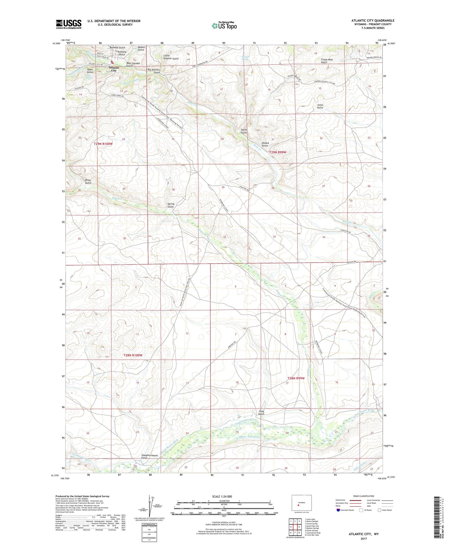
2021 topographic map quadrangle Atlantic City in the state of Wyoming. Scale: 1:24000. Based on the newly updated USGS 7.5' US Topo map series, this map is in the following counties: Fremont. The map contains contour data, water features, and other items you are used to seeing on USGS maps, but also has updated roads and other features. This is the next generation of topographic maps. Printed on high-quality waterproof paper with UV fade-resistant inks.
Quads adjacent to this one:
West: South Pass City
Northwest: Louis Lake
North: Miners Delight
Northeast: Gravel Spring
East: Radium Springs
Southeast: Circle Bar Lake
South: Continental Peak
Southwest: Dickie Springs
This map covers the same area as the classic USGS quad with code o42108d6.
Contains the following named places: Anthony Gulch, Atlantic City, Basket Gulch, Beaver Dam Ditch, Beer Garden Gulch, Big Atlantic Gulch, Burnt Ranch Ditch, Burnt Ranch Historical Monument, Carpenter Ranch, Custom Mill, Deep Gulch, Eight Lazy Y Ranch, Fremont County Fire Protection District Battalion 9 Atlantic City, Hyde Homestead, Last Crossing Ford Number 9, Little Atlantic Gulch, Little Beaver Creek, Long Gulch, Mary Ellen Mine, McTurk Spring, Mechanic and Emerald Lode, Obert Homestead, Omara Gulch, Oregon Slough, Rock Creek Ditch, Saint Louis Mines, Slaughterhouse Gulch, Smith Gulch, Spring Gulch, Tabor Grand Mine, Tabor Gulch, Tabor Spring, Willow Creek