MyTopo
Louis Lake Wyoming US Topo Map
Couldn't load pickup availability
Also explore the Louis Lake Forest Service Topo of this same quad for updated USFS data
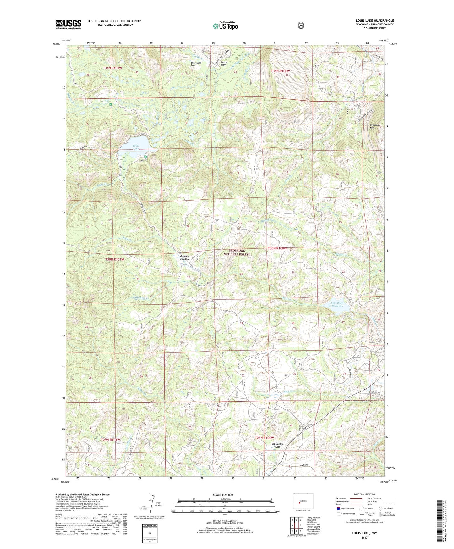
2021 topographic map quadrangle Louis Lake in the state of Wyoming. Scale: 1:24000. Based on the newly updated USGS 7.5' US Topo map series, this map is in the following counties: Fremont. The map contains contour data, water features, and other items you are used to seeing on USGS maps, but also has updated roads and other features. This is the next generation of topographic maps. Printed on high-quality waterproof paper with UV fade-resistant inks.
Quads adjacent to this one:
West: Christina Lake
Northwest: Cony Mountain
North: Fossil Hill
Northeast: Wolf Point
East: Miners Delight
Southeast: Atlantic City
South: South Pass City
Southwest: Anderson Ridge
This map covers the same area as the classic USGS quad with code o42108e7.
Contains the following named places: Abernathy Claim, Atlantic City Iron Mine, Atlantic Creek, Grannier Meadow, Hidden Creek, Limestone Mountain, Little Rock Creek, Louis Beach Campground, Louis Creek, Louis Lake, Louis Lake Campground, Louis Lake Guard Station, Louis Lake Picnic Area, Louis Lake Resort, Louis Lake Trail, Maxon Basin, Popo Agie Campground, Rock Creek Placers Mine, Sherwood Point, Shoshone Stock Driveway, Upper Rock Creek Dam, Upper Rock Creek Reservoir