MyTopo
Badwater SE Wyoming US Topo Map
Couldn't load pickup availability
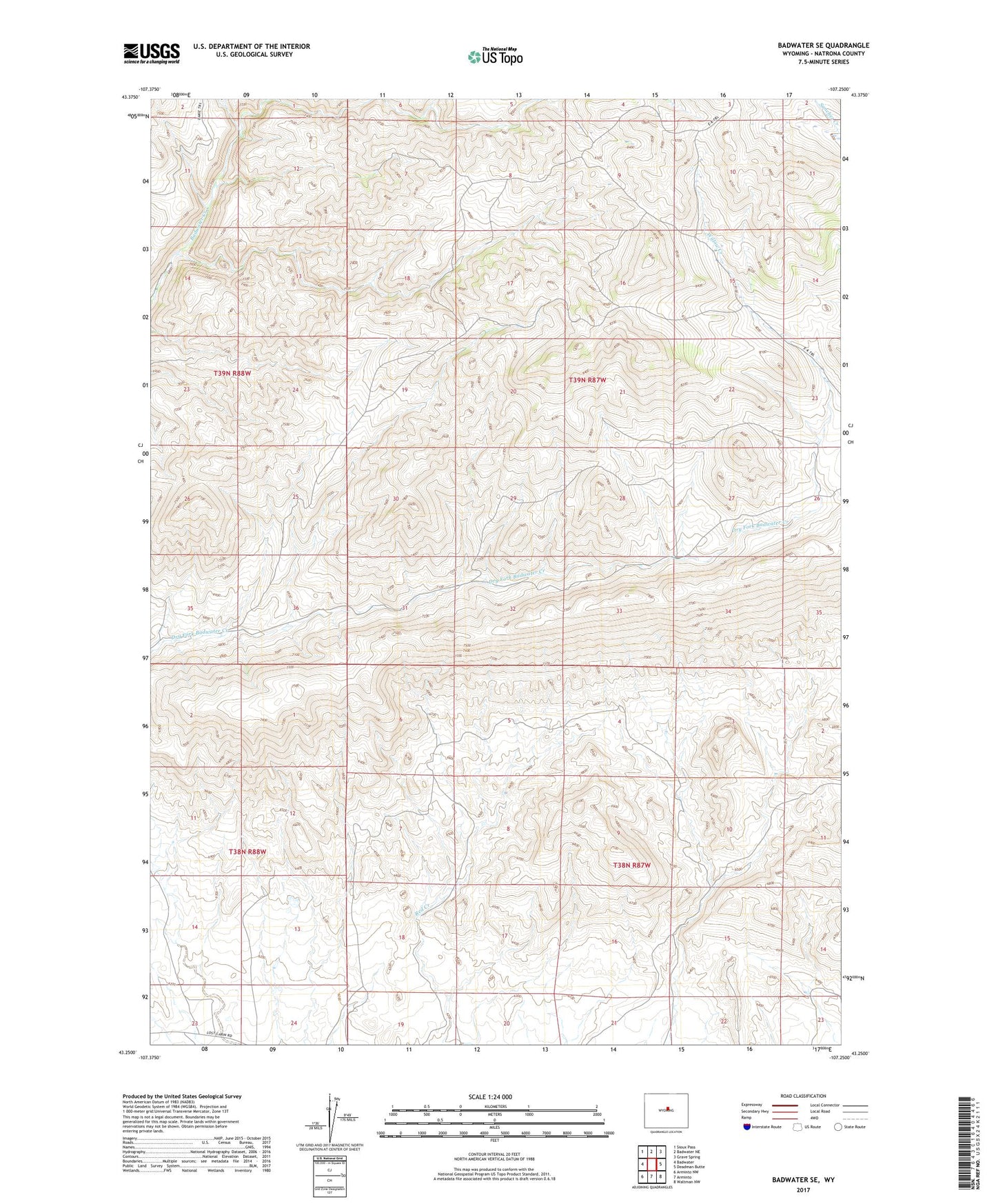
2021 topographic map quadrangle Badwater SE in the state of Wyoming. Scale: 1:24000. Based on the newly updated USGS 7.5' US Topo map series, this map is in the following counties: Natrona. The map contains contour data, water features, and other items you are used to seeing on USGS maps, but also has updated roads and other features. This is the next generation of topographic maps. Printed on high-quality waterproof paper with UV fade-resistant inks.
Quads adjacent to this one:
West: Badwater
Northwest: Sioux Pass
North: Badwater NE
Northeast: Grave Spring
East: Deadman Butte
Southeast: Waltman NW
South: Arminto
Southwest: Arminto NW
This map covers the same area as the classic USGS quad with code o43107c3.
Contains the following named places: Allie Claims, E-k Trail, Hitchcock Homestead, Lichty Cabin, Pine Ridge Dam, Pine Ridge Reservoir, Red Bluff Dam, Red Bluff Reservoir, Red Ranch, Red Ranch Dam, Red Ranch Reservoir, Three Forks Dam, Three Forks Reservoir, White Rock Dam, White Rock Reservoir, Willow Creek