MyTopo
Beartrap Meadows Wyoming US Topo Map
Couldn't load pickup availability
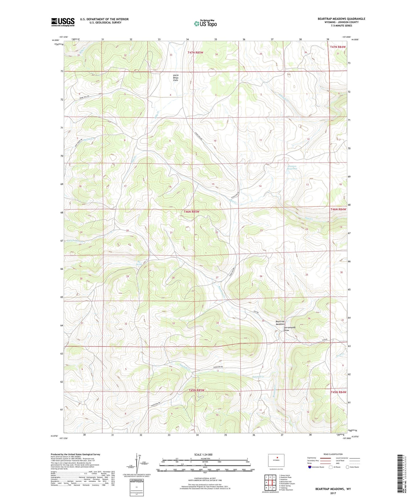
2021 topographic map quadrangle Beartrap Meadows in the state of Wyoming. Scale: 1:24000. Based on the newly updated USGS 7.5' US Topo map series, this map is in the following counties: Johnson. The map contains contour data, water features, and other items you are used to seeing on USGS maps, but also has updated roads and other features. This is the next generation of topographic maps. Printed on high-quality waterproof paper with UV fade-resistant inks.
Quads adjacent to this one:
West: Monument Hill
Northwest: Onion Gulch
North: Hazelton Peak
Northeast: Hazelton
East: Packsaddle Canyon
Southeast: Fraker Mountain
South: Tabletop
Southwest: Tallon Spring
Contains the following named places: Beartrap Meadows, Big Spring, Eychaner Dam, Eychaner Reservoir, Larramandy Draw, Larramandy Reservoir, Sawmill Creek, Seven Elk Reservoir, Simmon Reservoir, Uncle Billys Flats