MyTopo
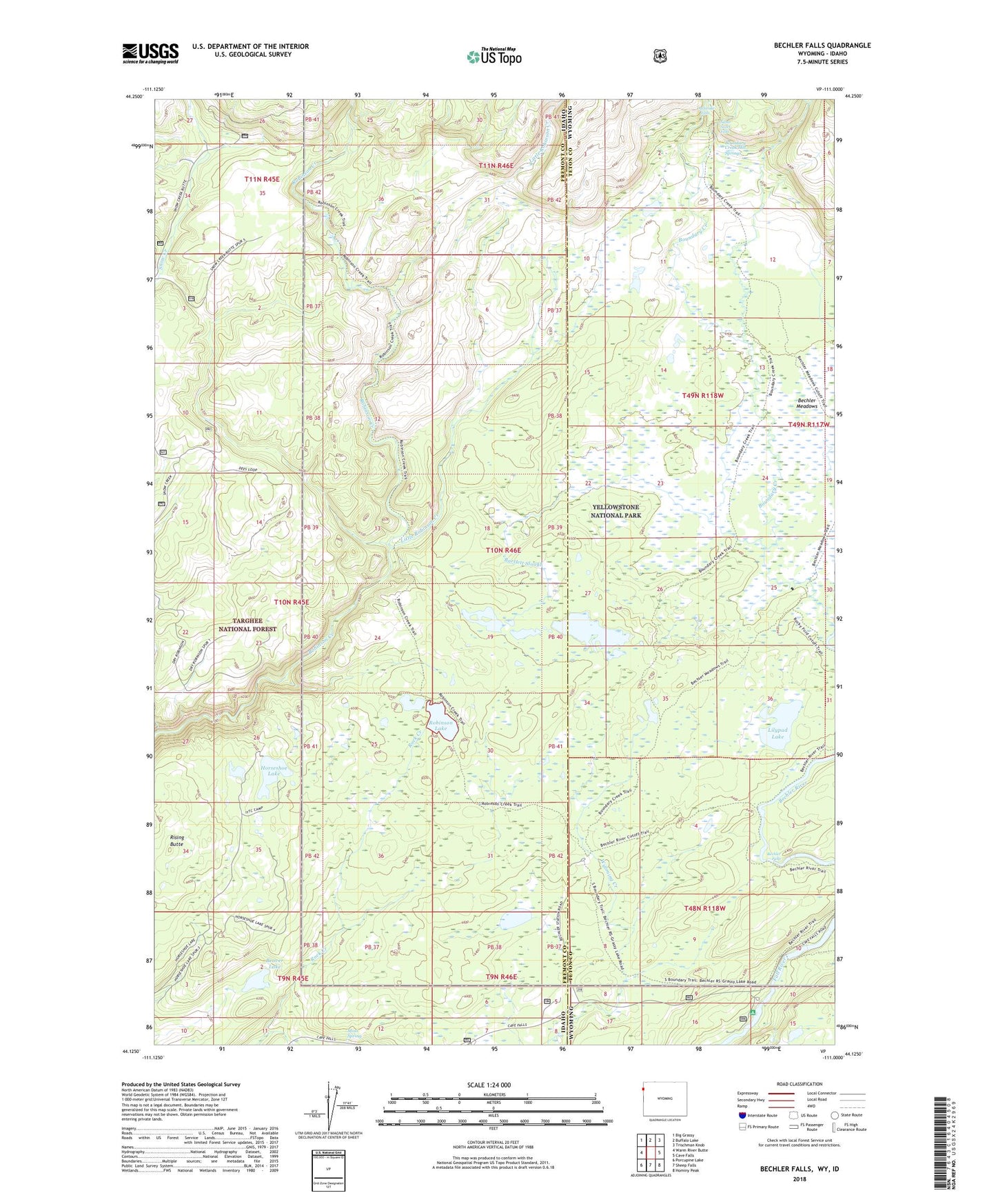
Bechler Falls Wyoming US Topo Map
Couldn't load pickup availability
Also explore the Bechler Falls Forest Service Topo of this same quad for updated USFS data
2021 topographic map quadrangle Bechler Falls in the states of Idaho, Wyoming. Scale: 1:24000. Based on the newly updated USGS 7.5' US Topo map series, this map is in the following counties: Teton, Fremont. The map contains contour data, water features, and other items you are used to seeing on USGS maps, but also has updated roads and other features. This is the next generation of topographic maps. Printed on high-quality waterproof paper with UV fade-resistant inks.
Quads adjacent to this one:
West: Warm River Butte
Northwest: Big Grassy
North: Buffalo Lake
Northeast: Trischman Knob
East: Cave Falls
Southeast: Hominy Peak
South: Sheep Falls
Southwest: Porcupine Lake
This map covers the same area as the classic USGS quad with code o44111b1.
Contains the following named places: Bartlett Slough, Beaver Lake, Bechler Falls, Bechler Meadows, Bechler River Ranger Station, Boundary Creek, Boundary Creek Hot Springs, Boundary Creek Patrol Cabin, Boundary Creek Trail, Cave Falls Campground, Dunanda Falls, Horseshoe Lake, Lilypad Lake, Little Robinson Creek, Moss Spring, Rising Butte, Robinson Lake, Silver Scarf Falls, Strong Creek, West Boundary Trail