MyTopo
Bessemer Mountain Wyoming US Topo Map
Couldn't load pickup availability
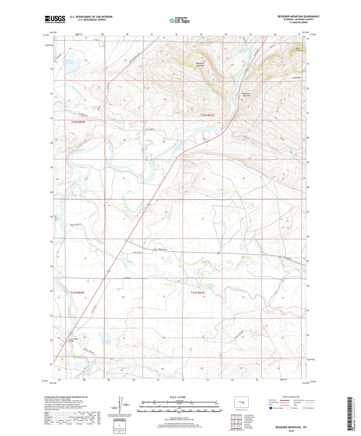
2021 topographic map quadrangle Bessemer Mountain in the state of Wyoming. Scale: 1:24000. Based on the newly updated USGS 7.5' US Topo map series, this map is in the following counties: Natrona. The map contains contour data, water features, and other items you are used to seeing on USGS maps, but also has updated roads and other features. This is the next generation of topographic maps. Printed on high-quality waterproof paper with UV fade-resistant inks.
Quads adjacent to this one:
West: Clarkson Hill
Northwest: Oil Mountain
North: Emigrant Gap
Northeast: Goose Egg
East: Freeland
Southeast: Twin Buttes
South: Alcova SE
Southwest: Alcova
Contains the following named places: Bates Creek, Bates Creek School, Bear Creek, Bessemer Mountain, Bessemer Narrows, Bolton Creek, Clark Ranch, Coal Creek, Cottonwood Creek, Goose Egg Number Two Mine, Goose Egg Spring, Government Bridge, Haygood Dam, Haygood Reservoir, O'Brien Dam, O'Brien Reservoir, Oregon Trail Historical Marker, Rasmus Lee Lake, Red Buttes, Speas Ranch, Stinking Creek, Two Bar Ranch, Willow Creek, Winter Crossing