MyTopo
Emigrant Gap Wyoming US Topo Map
Couldn't load pickup availability
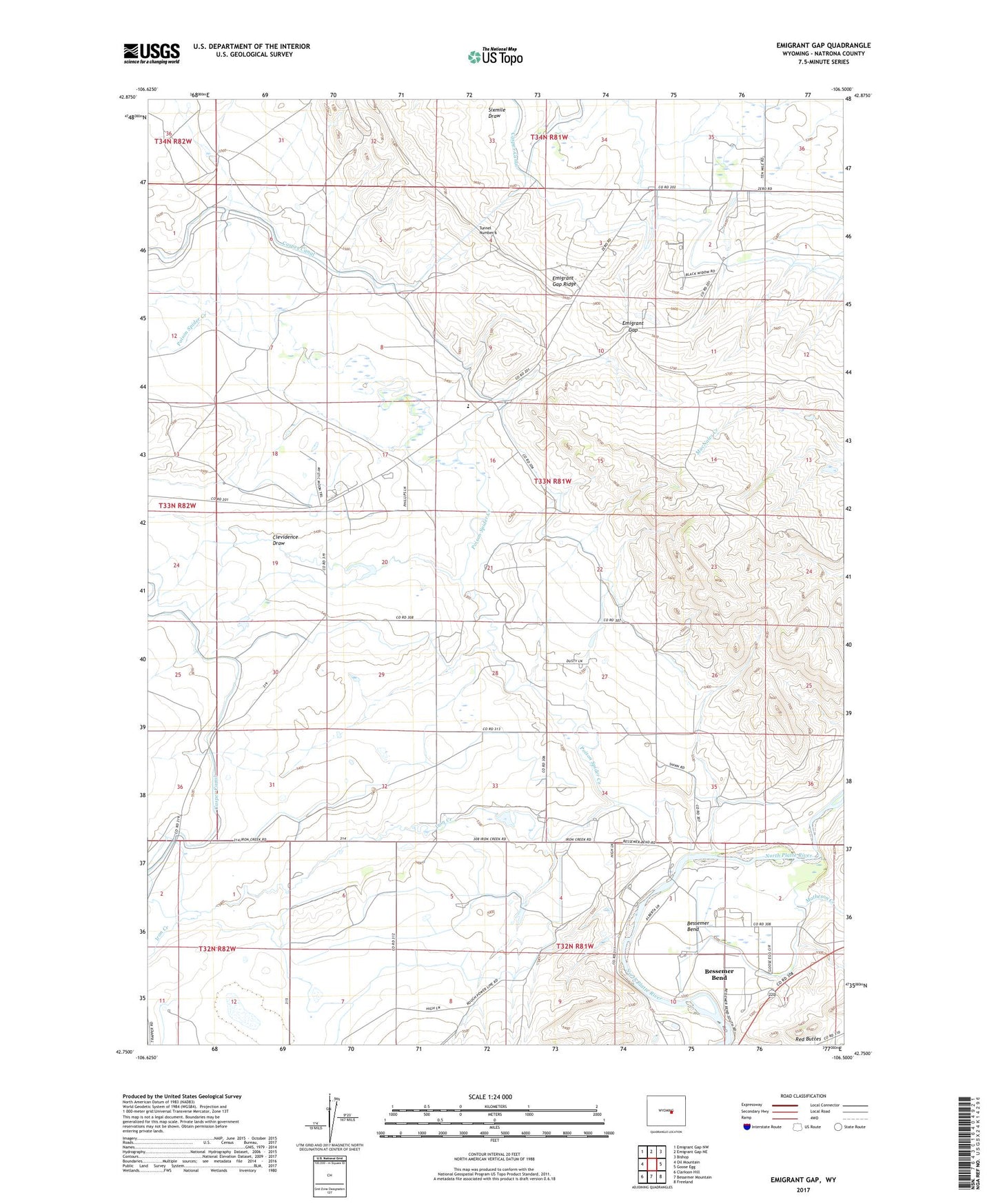
2021 topographic map quadrangle Emigrant Gap in the state of Wyoming. Scale: 1:24000. Based on the newly updated USGS 7.5' US Topo map series, this map is in the following counties: Natrona. The map contains contour data, water features, and other items you are used to seeing on USGS maps, but also has updated roads and other features. This is the next generation of topographic maps. Printed on high-quality waterproof paper with UV fade-resistant inks.
Quads adjacent to this one:
West: Oil Mountain
Northwest: Emigrant Gap NW
North: Emigrant Gap NE
Northeast: Bishop
East: Goose Egg
Southeast: Freeland
South: Bessemer Mountain
Southwest: Clarkson Hill
This map covers the same area as the classic USGS quad with code o42106g5.
Contains the following named places: Bessemer, Bessemer Bend, Bessemer Bend Census Designated Place, Clevidence Draw, Emigrant Gap, Iron Creek, Matheson Creek, Old Goose Egg Ranchhouse, Poison Spider Creek, Poison Spider Elementary School, Rosebud Pit Number Four, Soap Creek Number Two Mine, Tunnel Number 6