MyTopo
Goose Egg Wyoming US Topo Map
Couldn't load pickup availability
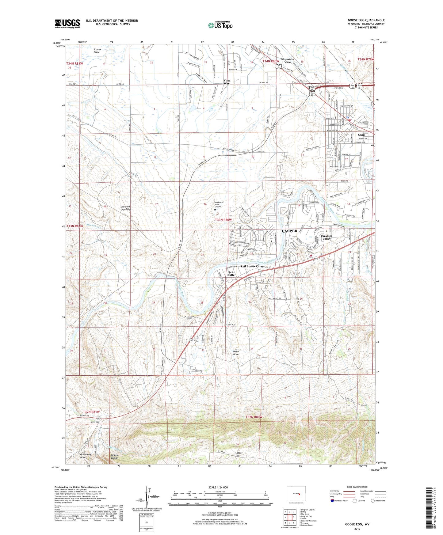
2023 topographic map quadrangle Goose Egg in the state of Wyoming. Scale: 1:24000. Based on the newly updated USGS 7.5' US Topo map series, this map is in the following counties: Natrona. The map contains contour data, water features, and other items you are used to seeing on USGS maps, but also has updated roads and other features. This is the next generation of topographic maps. Printed on high-quality waterproof paper with UV fade-resistant inks.
Quads adjacent to this one:
West: Emigrant Gap
Northwest: Emigrant Gap NE
North: Bishop
Northeast: The Reefs
East: Casper
Southeast: Crimson Dawn
South: Freeland
Southwest: Bessemer Mountain
This map covers the same area as the classic USGS quad with code o42106g4.
Contains the following named places: Blue Hill Deposit, Boels-Rimrock Pit, Casper Fire - Emergency Medical Services Station 6, Custard Massacre Site, Goose Egg, Goose Egg Number One Mine, Goose Egg Post Office, Gotheberg Draw, Horsch Stockwater Dam, Horsch Stockwater Reservoir, Izaak Walton Park, Jackson Canyon, MacNales Creek, Mills Fire Department, Mills Police Department, Mills Post Office, Mohawk Well, Mountain View, Mountain View Census Designated Place, Natrona County Fire Protection District West Station, Paradise Valley, Paradise Valley Country Club, Red Butte, Red Butte Census Designated Place, Red Buttes Burial Ground, Red Buttes Village, S P Dam, S P Reservoir, Soap Creek Number One Mine, Squaw Creek, Squaw Creek Ranch, Town of Mills, Vista West, Vista West Census Designated Place, Webb Draw, Wolf Creek