MyTopo
Freeland Wyoming US Topo Map
Couldn't load pickup availability
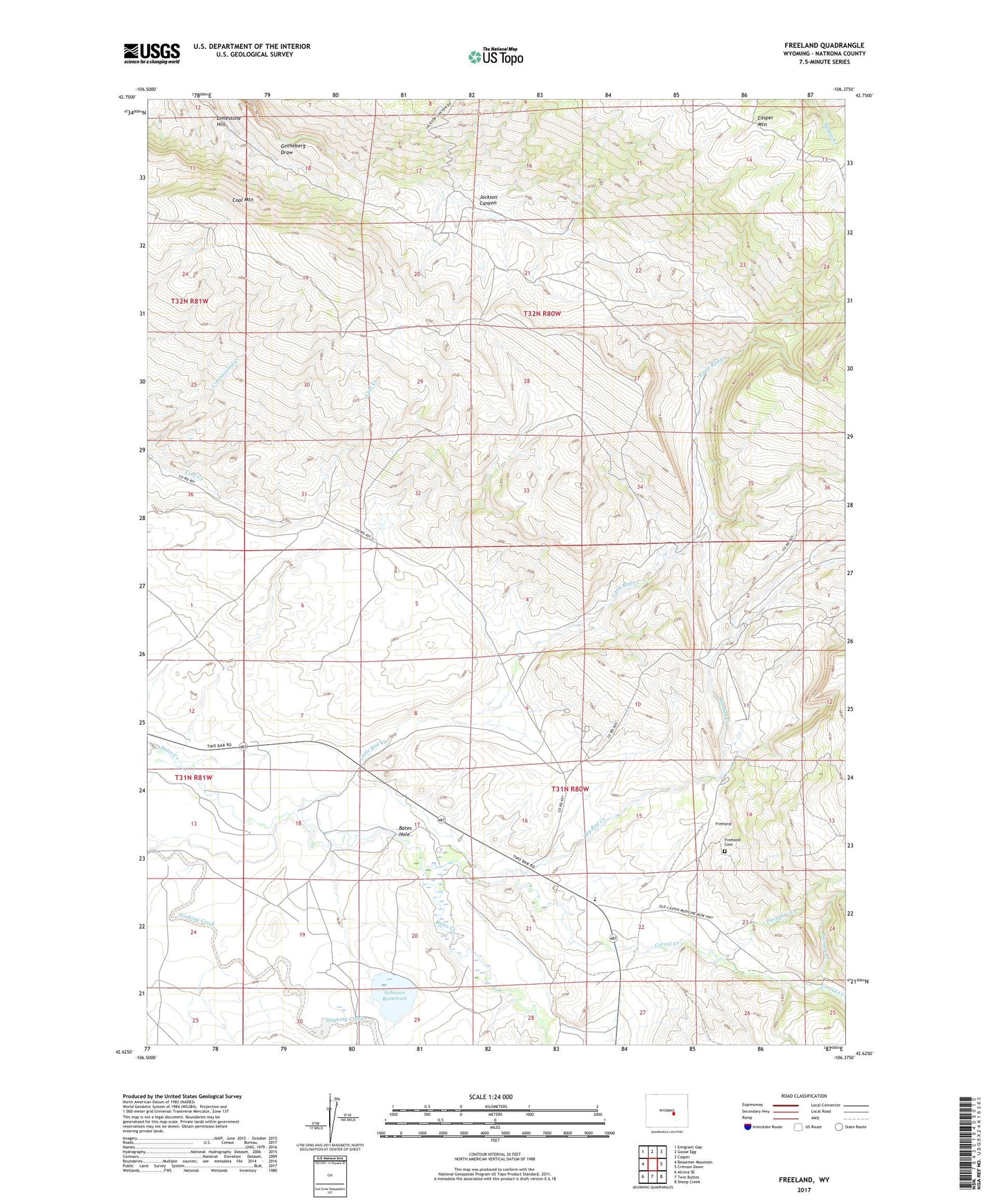
2023 topographic map quadrangle Freeland in the state of Wyoming. Scale: 1:24000. Based on the newly updated USGS 7.5' US Topo map series, this map is in the following counties: Natrona. The map contains contour data, water features, and other items you are used to seeing on USGS maps, but also has updated roads and other features. This is the next generation of topographic maps. Printed on high-quality waterproof paper with UV fade-resistant inks.
Quads adjacent to this one:
West: Bessemer Mountain
Northwest: Emigrant Gap
North: Goose Egg
Northeast: Casper
East: Crimson Dawn
Southeast: Sheep Creek
South: Twin Buttes
Southwest: Alcova SE
This map covers the same area as the classic USGS quad with code o42106f4.
Contains the following named places: Bates Creek Area Number One Mine, Bates Creek Area Number Two Mine, Bates Hole, Big Red Creek, Coal Mountain, Corral Creek, Crescent Ranch, Dry Lakes, Freeland Cemetery, Freeland Community Building, Freeland School, Garden Creek, Greene Place, Limestone Hill, Little Red Creek, Martin Ranch, McGraugh Ranch, Mills Place, Nall Ranch, Pitchpine Creek, Price Place, Schnoor Dam, Schnoor Ranch, Schnoor Reservoir