
MyTopo
Big Ridge Wyoming US Topo Map
Couldn't load pickup availability
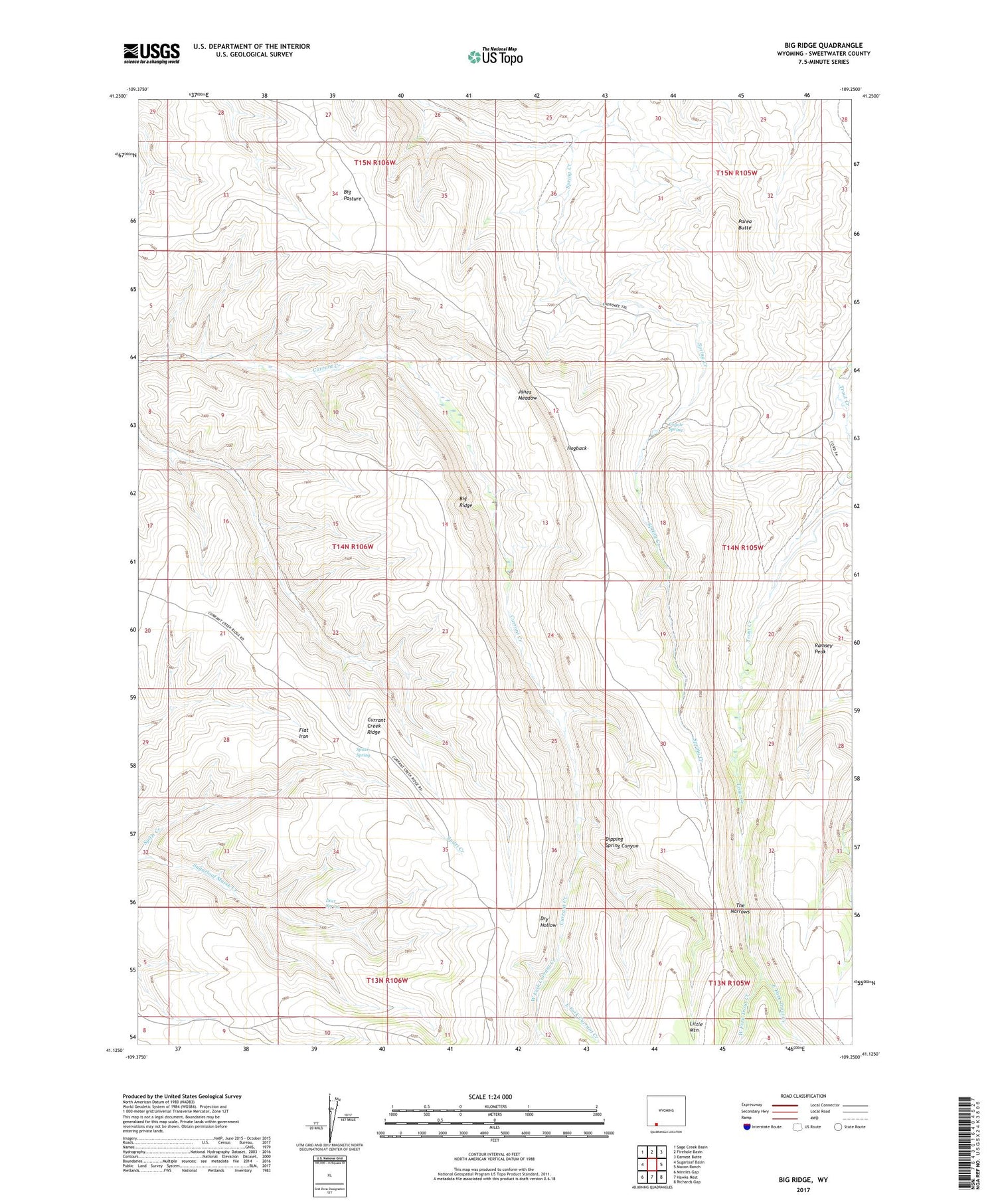
2021 topographic map quadrangle Big Ridge in the state of Wyoming. Scale: 1:24000. Based on the newly updated USGS 7.5' US Topo map series, this map is in the following counties: Sweetwater. The map contains contour data, water features, and other items you are used to seeing on USGS maps, but also has updated roads and other features. This is the next generation of topographic maps. Printed on high-quality waterproof paper with UV fade-resistant inks.
Quads adjacent to this one:
West: Sugarloaf Basin
Northwest: Sage Creek Basin
North: Firehole Basin
Northeast: Earnest Butte
East: Maxon Ranch
Southeast: Richards Gap
South: Hawks Nest
Southwest: Minnies Gap
Contains the following named places: Big Pasture, Big Ridge, Coyote Spring, Currant Creek Ridge, Deer Spring, Dipping Spring Canyon, East Fork Currant Creek, East Fork Trout Creek, Flat Iron, Hogback, Janes Meadow, Little Mountain, Middle Fork Currant Creek, Parea Butte, Ramsey Peak, Spitzi Creek, Spitzi Spring, The Narrows, West Fork Currant Creek, West Fork Trout Creek


