MyTopo
Minnies Gap Wyoming US Topo Map
Couldn't load pickup availability
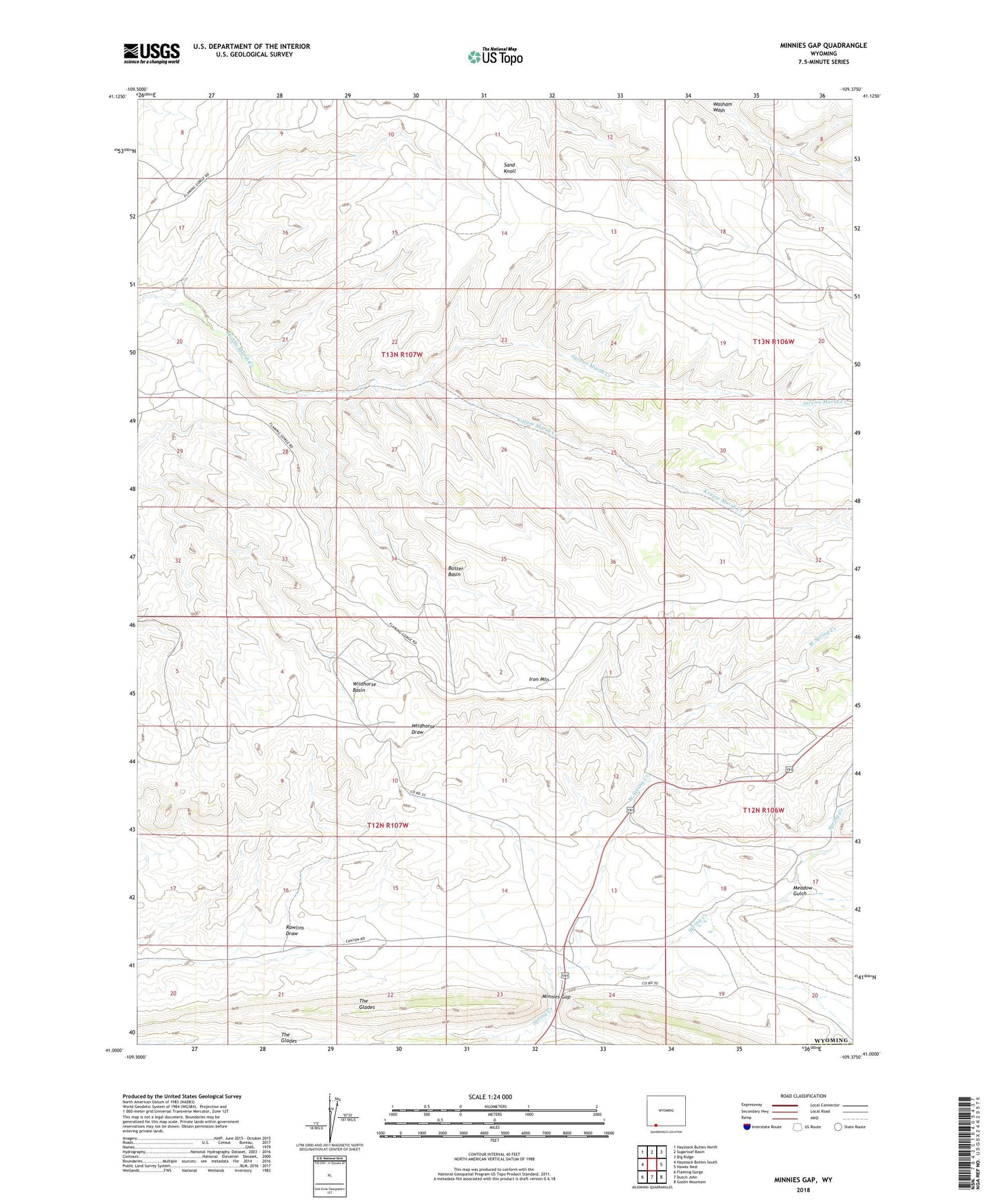
2021 topographic map quadrangle Minnies Gap in the state of Wyoming. Scale: 1:24000. Based on the newly updated USGS 7.5' US Topo map series, this map is in the following counties: Sweetwater. The map contains contour data, water features, and other items you are used to seeing on USGS maps, but also has updated roads and other features. This is the next generation of topographic maps. Printed on high-quality waterproof paper with UV fade-resistant inks.
Quads adjacent to this one:
West: Haystack Buttes South
Northwest: Haystack Buttes North
North: Sugarloaf Basin
Northeast: Big Ridge
East: Hawks Nest
Southeast: Goslin Mountain
South: Dutch John
Southwest: Flaming Gorge
This map covers the same area as the classic USGS quad with code o41109a4.
Contains the following named places: Buster Basin, Canyon Road Trail, Iron Mountain, Jarvies Marsh Creek, Krause Marsh Creek, Little Mountain Mine, Meadow Gulch, Minnies Gap, Rawlins Draw, Sand Knoll, West Spring Creek, Wildhorse Basin