MyTopo
Maxon Ranch Wyoming US Topo Map
Couldn't load pickup availability
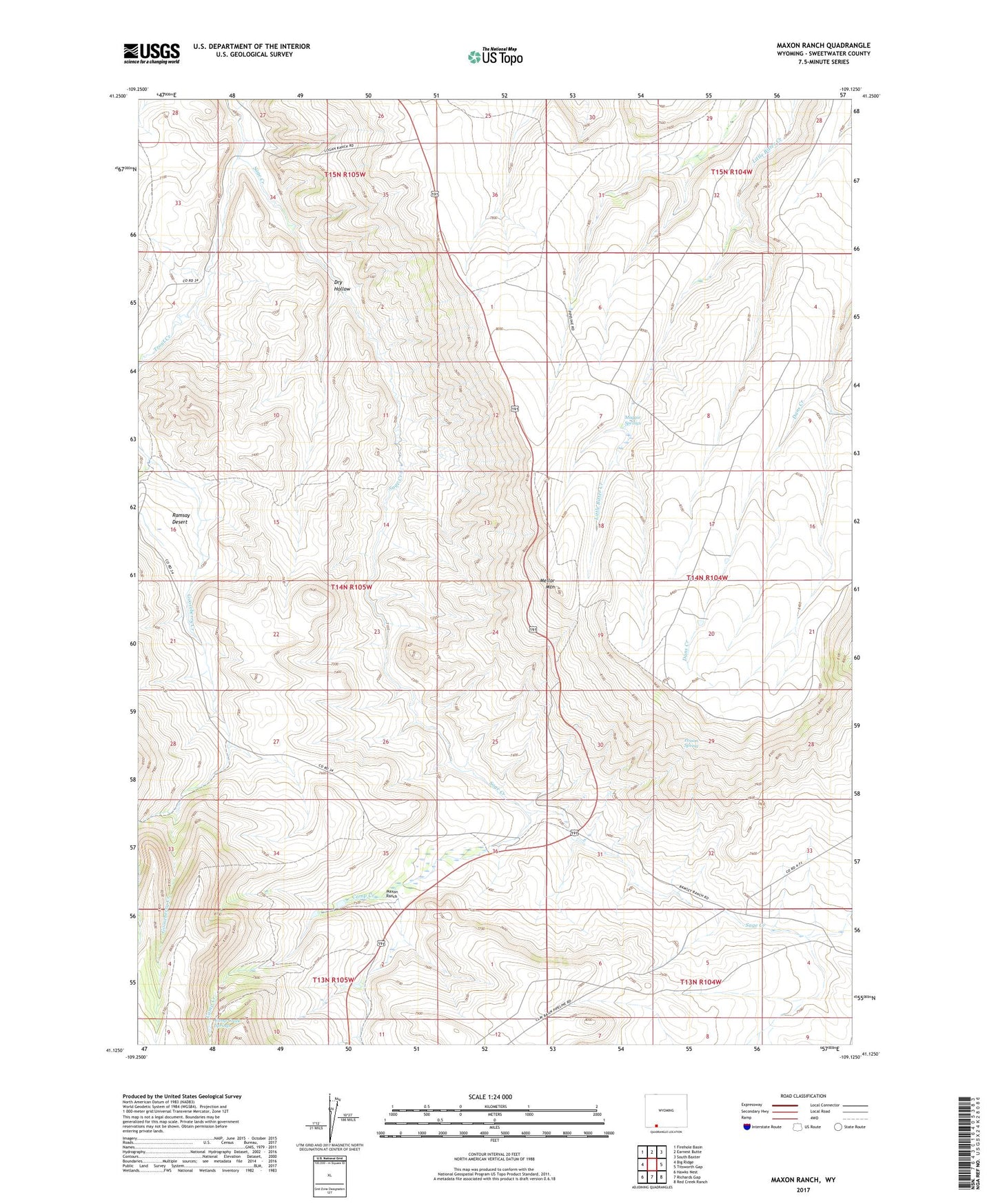
2021 topographic map quadrangle Maxon Ranch in the state of Wyoming. Scale: 1:24000. Based on the newly updated USGS 7.5' US Topo map series, this map is in the following counties: Sweetwater. The map contains contour data, water features, and other items you are used to seeing on USGS maps, but also has updated roads and other features. This is the next generation of topographic maps. Printed on high-quality waterproof paper with UV fade-resistant inks.
Quads adjacent to this one:
West: Big Ridge
Northwest: Firehole Basin
North: Earnest Butte
Northeast: South Baxter
East: Titsworth Gap
Southeast: Red Creek Ranch
South: Richards Gap
Southwest: Hawks Nest
This map covers the same area as the classic USGS quad with code o41109b2.
Contains the following named places: Camp Creek, Camp Creek Springs, Dry Hollow, Gooseberry Creek, Logan Place, Maggie Springs, Maxon Ranch, Mellor Mountain, Poison Spring, Ramsay Desert, Ramsay Ranch, Trout Creek