MyTopo
Split Rock Wyoming US Topo Map
Couldn't load pickup availability
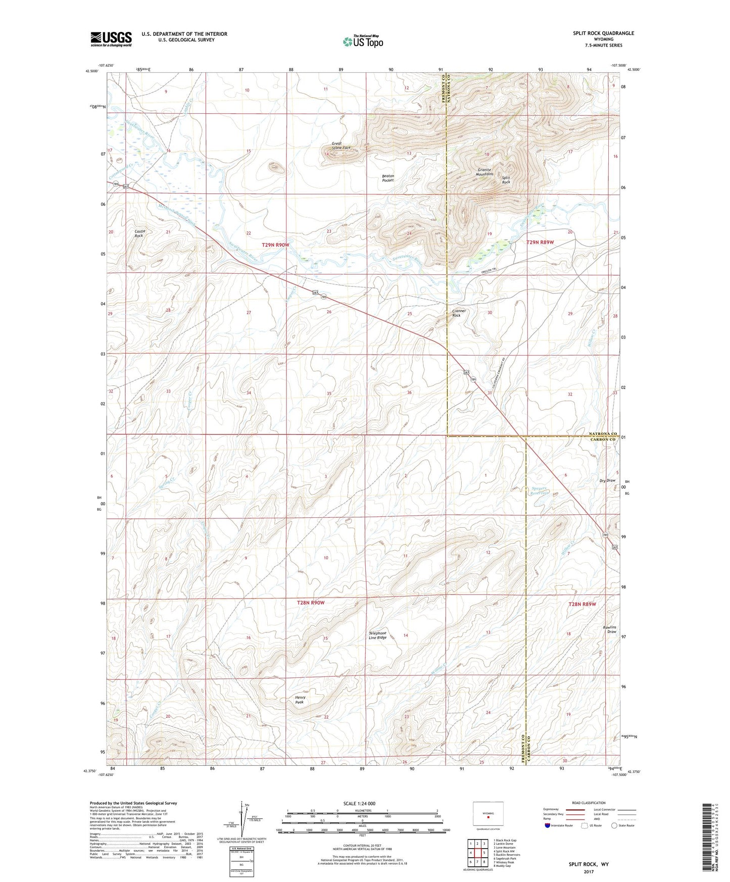
2021 topographic map quadrangle Split Rock in the state of Wyoming. Scale: 1:24000. Based on the newly updated USGS 7.5' US Topo map series, this map is in the following counties: Fremont, Natrona, Carbon. The map contains contour data, water features, and other items you are used to seeing on USGS maps, but also has updated roads and other features. This is the next generation of topographic maps. Printed on high-quality waterproof paper with UV fade-resistant inks.
Quads adjacent to this one:
West: Split Rock NW
Northwest: Black Rock Gap
North: Lankin Dome
Northeast: Lone Mountain
East: Bucklin Reservoirs
Southeast: Muddy Gap
South: Whiskey Peak
Southwest: Sagebrush Park
This map covers the same area as the classic USGS quad with code o42107d5.
Contains the following named places: Al Claim Group Mine, Beaton Pocket, Casper Creek Mine, Castle Rock, Cooper Creek, Cottonwood Creek, Cranner Rock, Great Stone Face, Grieves Homestead, Grieves Ranch, Hat Ranch, Henry Peak, Lankin Creek, McIntosh Beaton Ditch, McIntosh Ranch, Mohawk Number Two Mine, Speyerer Dam, Speyers Homestead, Speyers Reservoir, Split Rock, Split Rock Area Mine, Split Rock Area Number One Mine, Split Rock Area Number Two Mine, Split Rock Ranch, Split Rock School, Spring Creek, Telephone Line Ridge