MyTopo
Blue Gap Wyoming US Topo Map
Couldn't load pickup availability
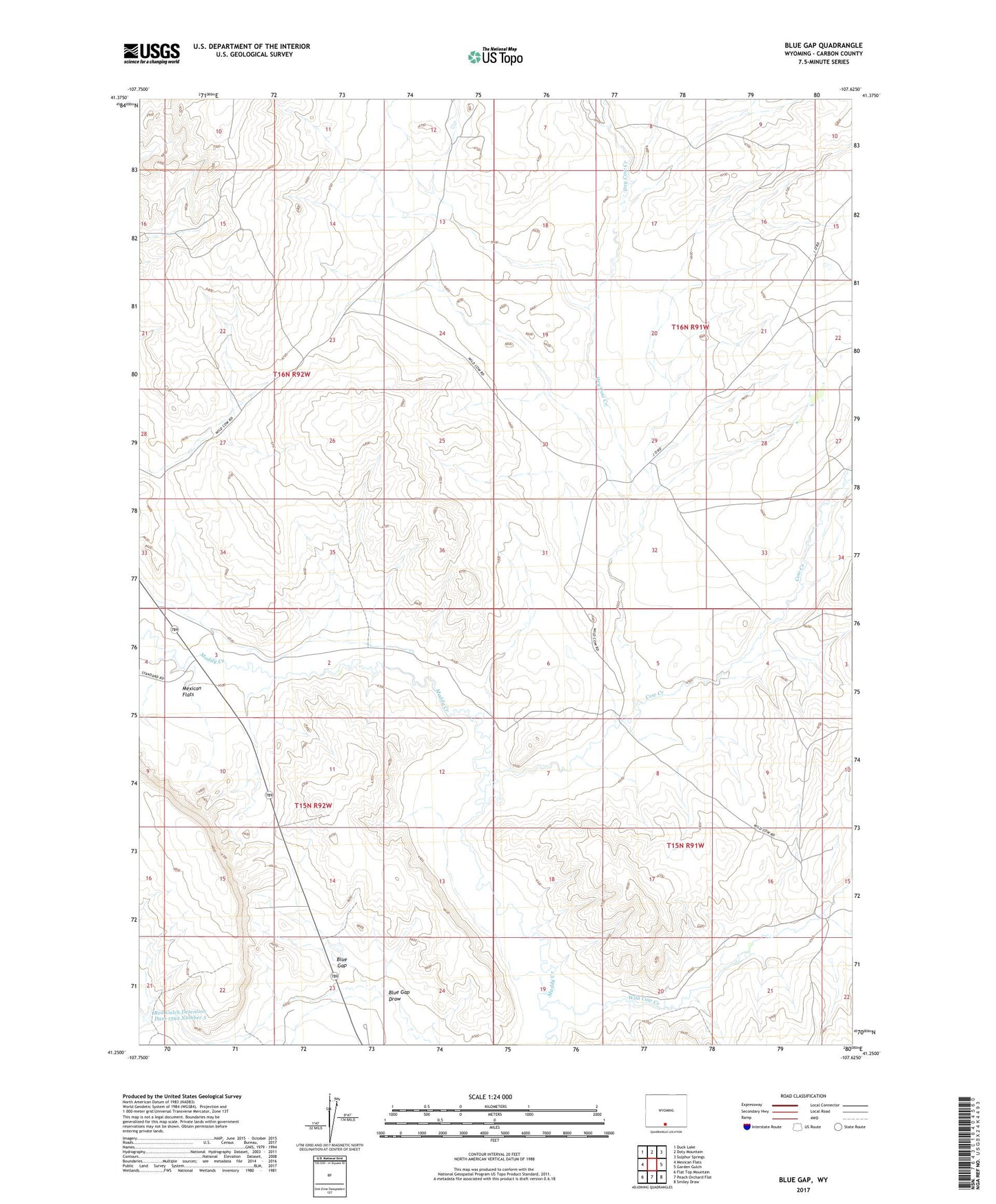
2021 topographic map quadrangle Blue Gap in the state of Wyoming. Scale: 1:24000. Based on the newly updated USGS 7.5' US Topo map series, this map is in the following counties: Carbon. The map contains contour data, water features, and other items you are used to seeing on USGS maps, but also has updated roads and other features. This is the next generation of topographic maps. Printed on high-quality waterproof paper with UV fade-resistant inks.
Quads adjacent to this one:
West: Mexican Flats
Northwest: Duck Lake
North: Doty Mountain
Northeast: Sulphur Springs
East: Garden Gulch
Southeast: Smiley Draw
South: Peach Orchard Flat
Southwest: Flat Top Mountain
This map covers the same area as the classic USGS quad with code o41107c6.
Contains the following named places: Blue Gap, Cow Creek, Dry Cow Creek, Muddy Bridge Mine, Red Gulch Detention Dam 1592 Number 3, Red Gulch Detention Dam 1592 Number 5, Soldiers Well, Wild Cow Creek