MyTopo
Sulphur Springs Wyoming US Topo Map
Couldn't load pickup availability
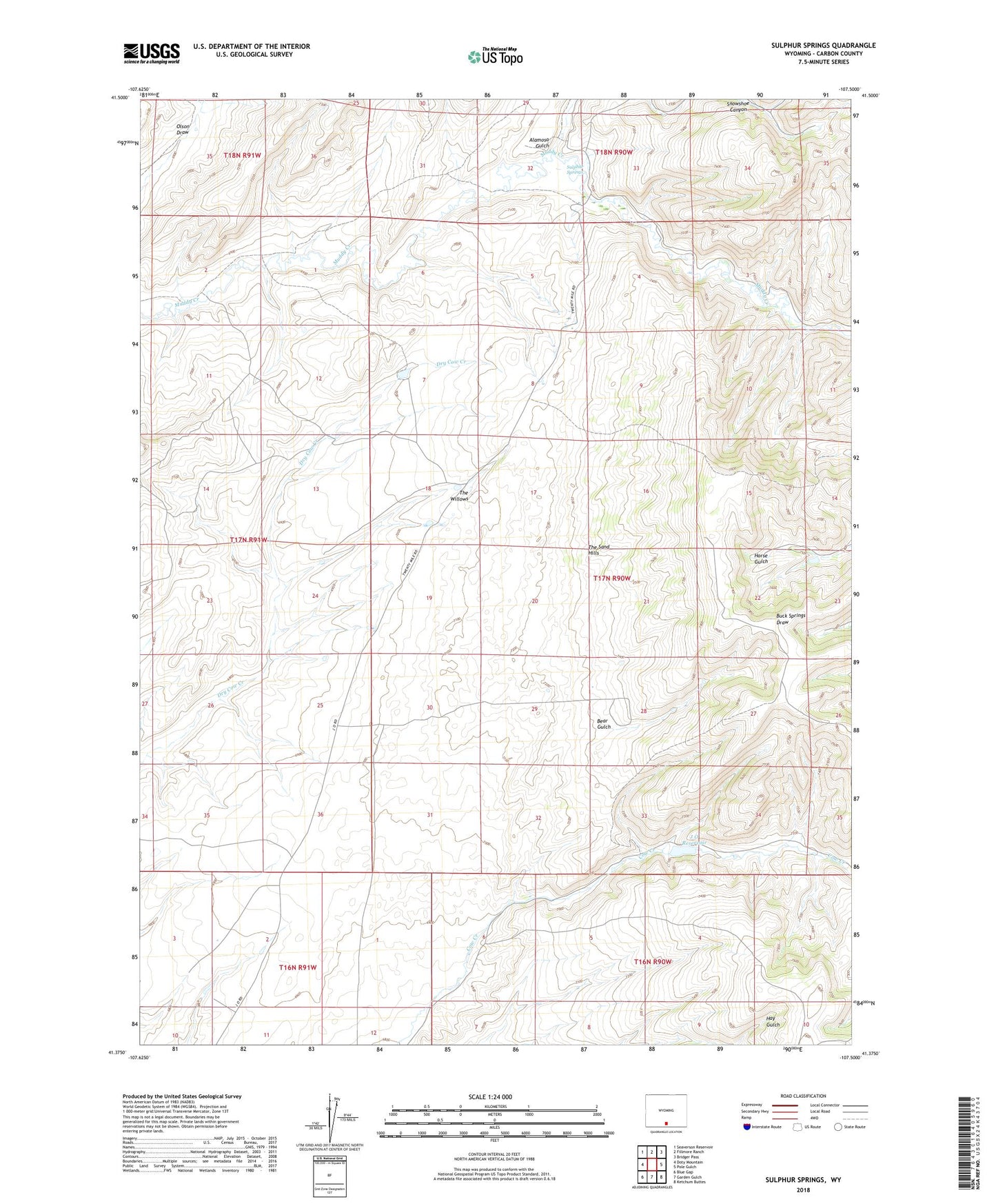
2021 topographic map quadrangle Sulphur Springs in the state of Wyoming. Scale: 1:24000. Based on the newly updated USGS 7.5' US Topo map series, this map is in the following counties: Carbon. The map contains contour data, water features, and other items you are used to seeing on USGS maps, but also has updated roads and other features. This is the next generation of topographic maps. Printed on high-quality waterproof paper with UV fade-resistant inks.
Quads adjacent to this one:
West: Doty Mountain
Northwest: Seaverson Reservoir
North: Fillmore Ranch
Northeast: Bridger Pass
East: Pole Gulch
Southeast: Ketchum Buttes
South: Garden Gulch
Southwest: Blue Gap
This map covers the same area as the classic USGS quad with code o41107d5.
Contains the following named places: Alamosa Gulch, Bear Gulch, J O Dam, J O Reservoir, Original Stage Station, Robertson Mine, Sulphur Springs Ranch, The Sand Hills, The Willows