MyTopo
Bradley Peak Wyoming US Topo Map
Couldn't load pickup availability
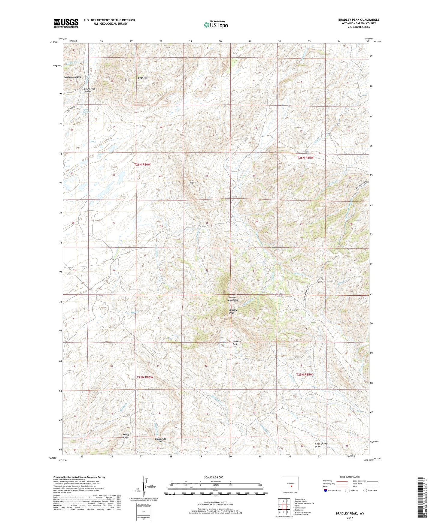
2021 topographic map quadrangle Bradley Peak in the state of Wyoming. Scale: 1:24000. Based on the newly updated USGS 7.5' US Topo map series, this map is in the following counties: Carbon. The map contains contour data, water features, and other items you are used to seeing on USGS maps, but also has updated roads and other features. This is the next generation of topographic maps. Printed on high-quality waterproof paper with UV fade-resistant inks.
Quads adjacent to this one:
West: Ferris
Northwest: Spanish Mine
North: Buzzard Ranch
Northeast: Pathfinder Reservoir SW
East: Seminoe Dam
Southeast: Seminoe Dam SW
South: Wild Horse Mountain
Southwest: Riddle Cut
This map covers the same area as the classic USGS quad with code o42107b1.
Contains the following named places: Bear Mountain, Boot Creek, Boot Ranch, Bradley Peak, Bradley Peak Mine, Cannon Creek, Denn Wyoming Mine, East Twin Creek, Elkhorn Stage Station, Field House Mine, Fieldhouse Cut, Junk Creek Mines, Junk Hill, Kronkneit Mine, Long Creek Area Three Mine, Long Creek Area Two Mine, Mahoney Lake, Pattison Basin, Penn Mine, R S Ranch, Sand Springs, School Creek, Seminoe Mountains Area Mine, Sunday Morning Mine, Turkey Creek, Twin Creek, West Junk Creek, West Twin Creek