MyTopo
Pathfinder Reservoir SW Wyoming US Topo Map
Couldn't load pickup availability
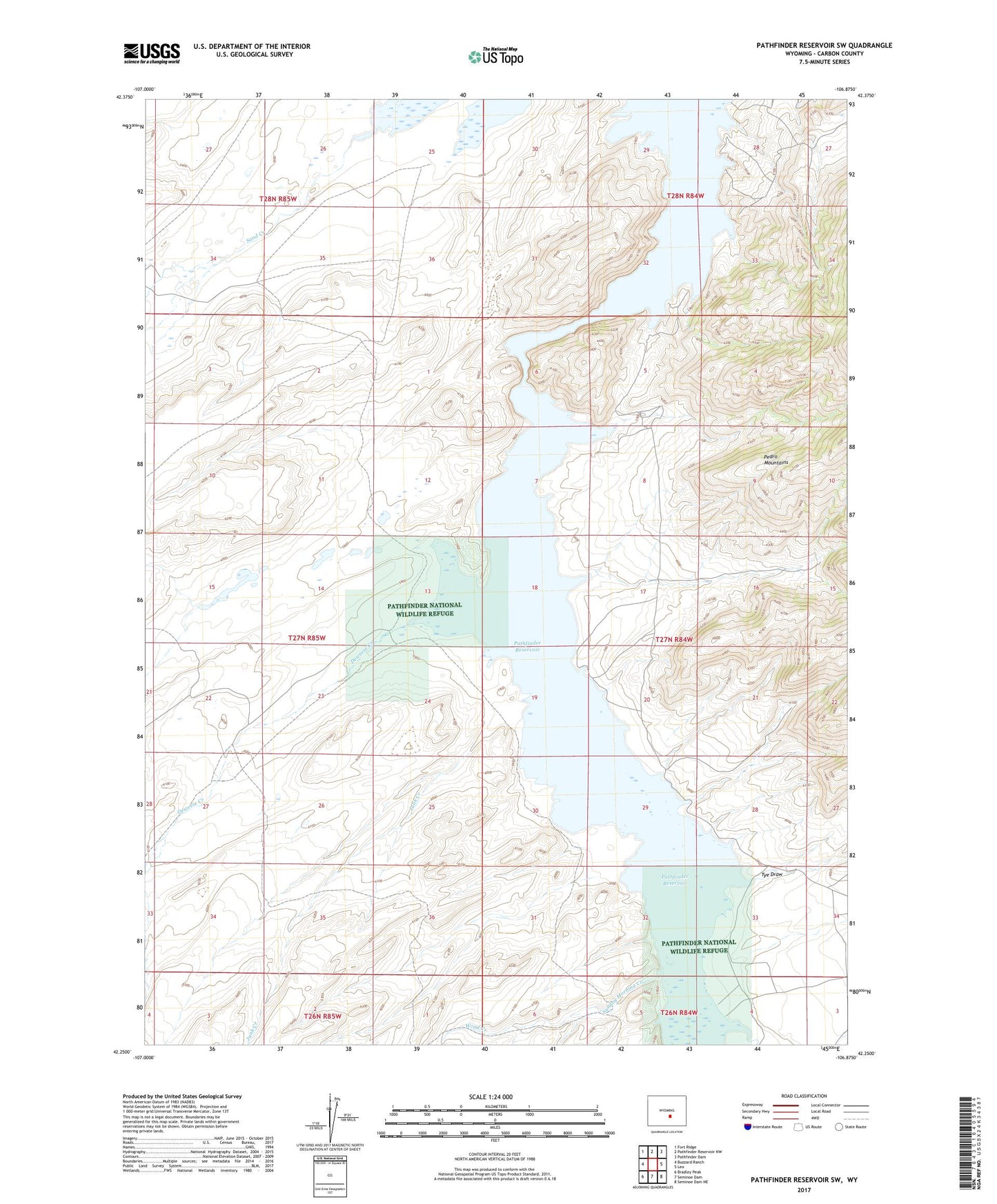
2021 topographic map quadrangle Pathfinder Reservoir SW in the state of Wyoming. Scale: 1:24000. Based on the newly updated USGS 7.5' US Topo map series, this map is in the following counties: Carbon. The map contains contour data, water features, and other items you are used to seeing on USGS maps, but also has updated roads and other features. This is the next generation of topographic maps. Printed on high-quality waterproof paper with UV fade-resistant inks.
Quads adjacent to this one:
West: Buzzard Ranch
Northwest: Fort Ridge
North: Pathfinder Reservoir NW
Northeast: Pathfinder Dam
East: Leo
Southeast: Seminoe Dam NE
South: Seminoe Dam
Southwest: Bradley Peak
This map covers the same area as the classic USGS quad with code o42106c8.
Contains the following named places: Bear Creek, Deweese Creek, Junk Creek, Nickerson Dam, Nickerson Reservoir, Park Ranch, Sage Creek, Sand Creek, Spurlock Dam, Spurlock Reservoir, Sunday Morning Creek, Tye Draw, Wood Creek