MyTopo
Hyattville Wyoming US Topo Map
Couldn't load pickup availability
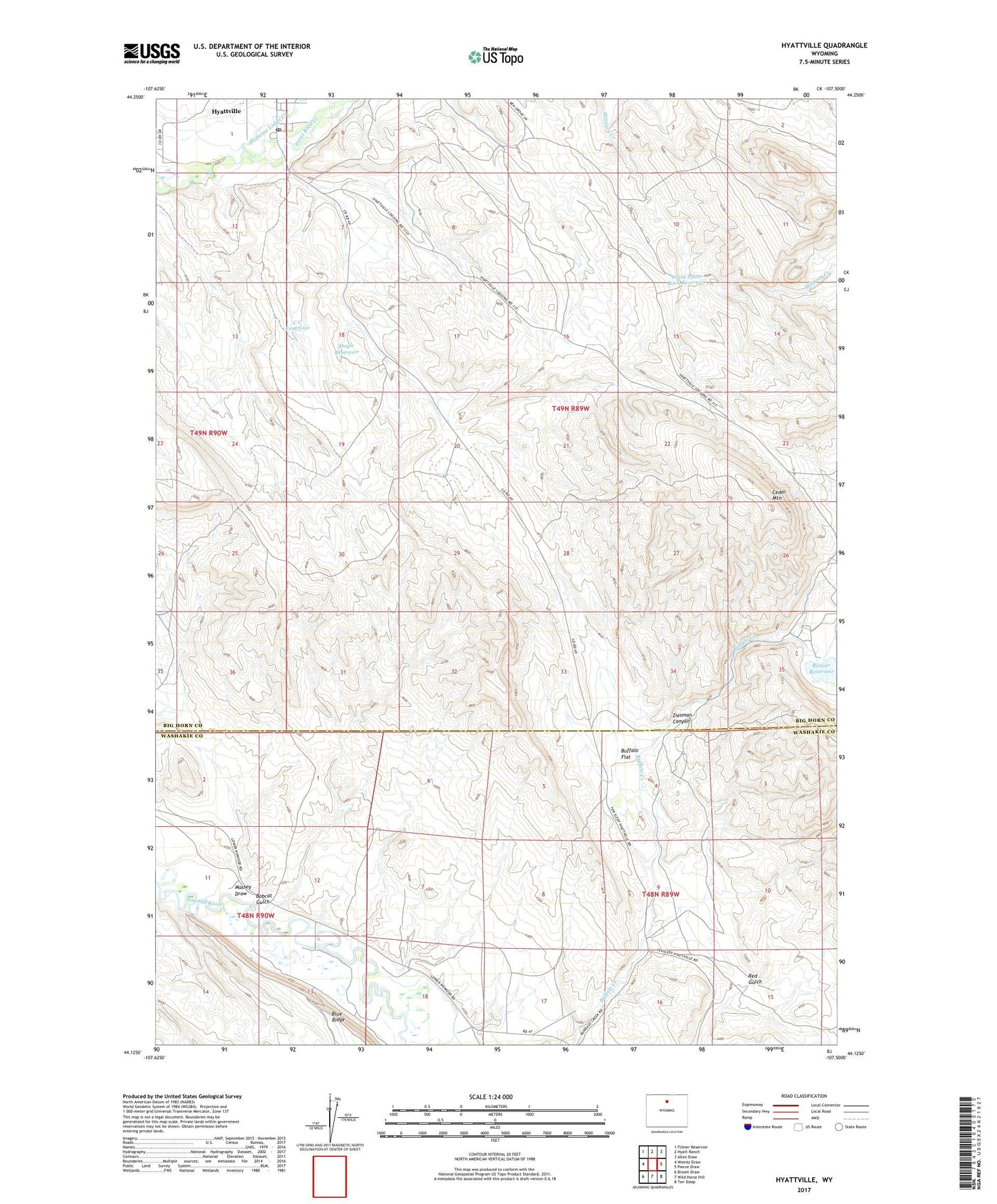
2021 topographic map quadrangle Hyattville in the state of Wyoming. Scale: 1:24000. Based on the newly updated USGS 7.5' US Topo map series, this map is in the following counties: Big Horn, Washakie. The map contains contour data, water features, and other items you are used to seeing on USGS maps, but also has updated roads and other features. This is the next generation of topographic maps. Printed on high-quality waterproof paper with UV fade-resistant inks.
Quads adjacent to this one:
West: Weintz Draw
Northwest: Flitner Reservoir
North: Hyatt Ranch
Northeast: Allen Draw
East: Pierce Draw
Southeast: Ten Sleep
South: Wild Horse Hill
Southwest: Broom Draw
This map covers the same area as the classic USGS quad with code o44107b5.
Contains the following named places: Bobcat Gulch, Buffalo Flat, Burgess Claim, C C Reservoir, Cedar Mountain, Coon Hollow, Doyle Reservoir, Hyattville, Hyattville Census Designated Place, Hyattville Post Office, Hyattville School, Massey Draw, Medicine Lodge Creek, Pearce Well, Renner Dam, Renner Reservoir, Smiths Ranch, South Paint Rock Reservoir, Ziesman Canyon