MyTopo
Funny Rock Wyoming US Topo Map
Couldn't load pickup availability
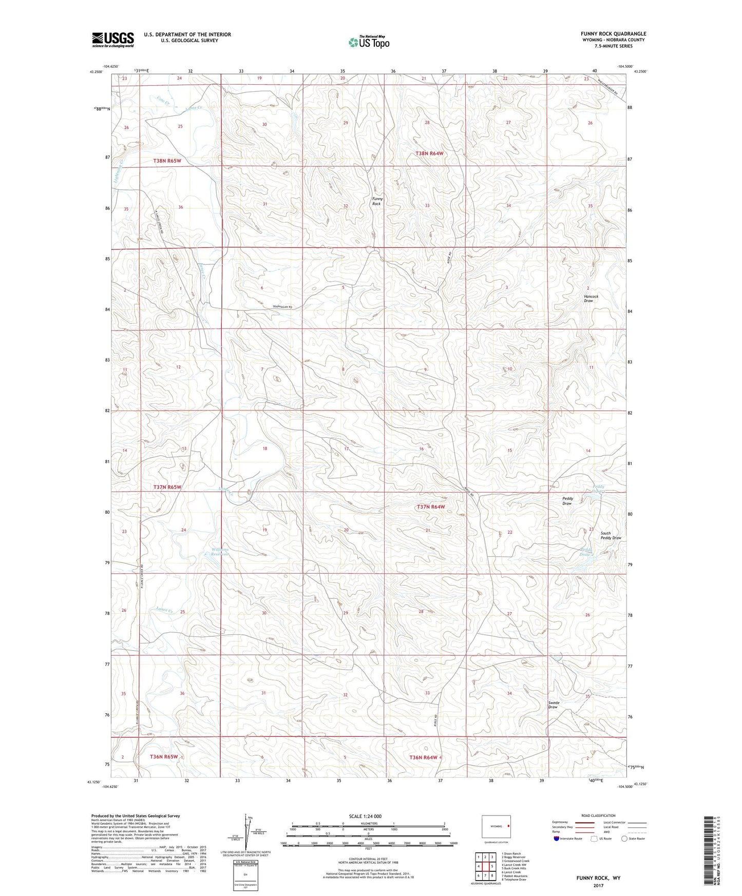
2021 topographic map quadrangle Funny Rock in the state of Wyoming. Scale: 1:24000. Based on the newly updated USGS 7.5' US Topo map series, this map is in the following counties: Niobrara. The map contains contour data, water features, and other items you are used to seeing on USGS maps, but also has updated roads and other features. This is the next generation of topographic maps. Printed on high-quality waterproof paper with UV fade-resistant inks.
Quads adjacent to this one:
West: Lance Creek NW
Northwest: Dixon Ranch
North: Boggy Reservoir
Northeast: Greasewood Creek
East: Buck Creek Hills
Southeast: Telephone Draw
South: Rabbit Mountains
Southwest: Lance Creek
This map covers the same area as the classic USGS quad with code o43104b5.
Contains the following named places: Boggy Reservoir, Cow Creek, Cow Creek School, Funny Rock, Lightning Creek, Paddy Number 1 Dam, Paddy Number 1 Reservoir, Paddy Number 2 Dam, Paddy Number 2 Reservoir, Peddy Draw 1, Peddy Draw 2, Pronghorn Dam, Pronghorn Reservoir, Williams Dam, Williams Reservoir