
MyTopo
Buck Fever Ridge Wyoming US Topo Map
Couldn't load pickup availability
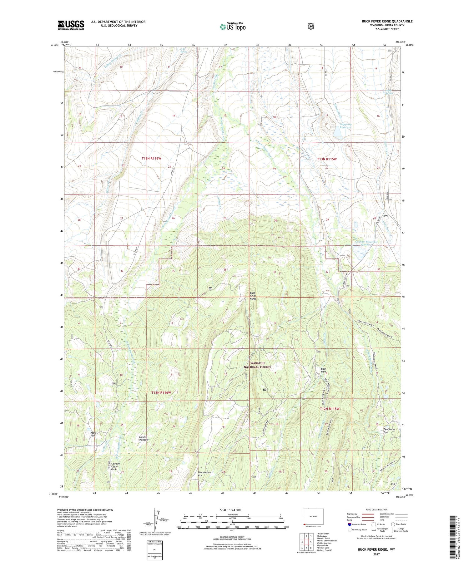
2021 topographic map quadrangle Buck Fever Ridge in the state of Wyoming. Scale: 1:24000. Based on the newly updated USGS 7.5' US Topo map series, this map is in the following counties: Uinta. The map contains contour data, water features, and other items you are used to seeing on USGS maps, but also has updated roads and other features. This is the next generation of topographic maps. Printed on high-quality waterproof paper with UV fade-resistant inks.
Quads adjacent to this one:
West: Meeks Cabin Reservoir
Northwest: Hague Creek
North: Robertson
Northeast: Leavitt Bench
East: Table Mountain
Southeast: Gilbert Peak NE
South: Bridger Lake
Southwest: Lyman Lake
Contains the following named places: Antone Creek, Archie Creek, Botero Ditch, Buck Fever Ridge, Cold Spring, Cowboy Cabin Park, Deadhorse Park, Deadhorse State Hospital Camp, East Fork Smiths Fork, Gilbert Creek, Graham Dam, Graham Reservoir Number 1, Jacks Park, Lambs Meadow, Little Gilbert Creek, Murray Ditch, Murray Reservoir, Perry Ranch, Rocky Springs, Slab Park, Thunderbolt Mountain, Tipperary Dam, West Fork Smiths Fork


