MyTopo
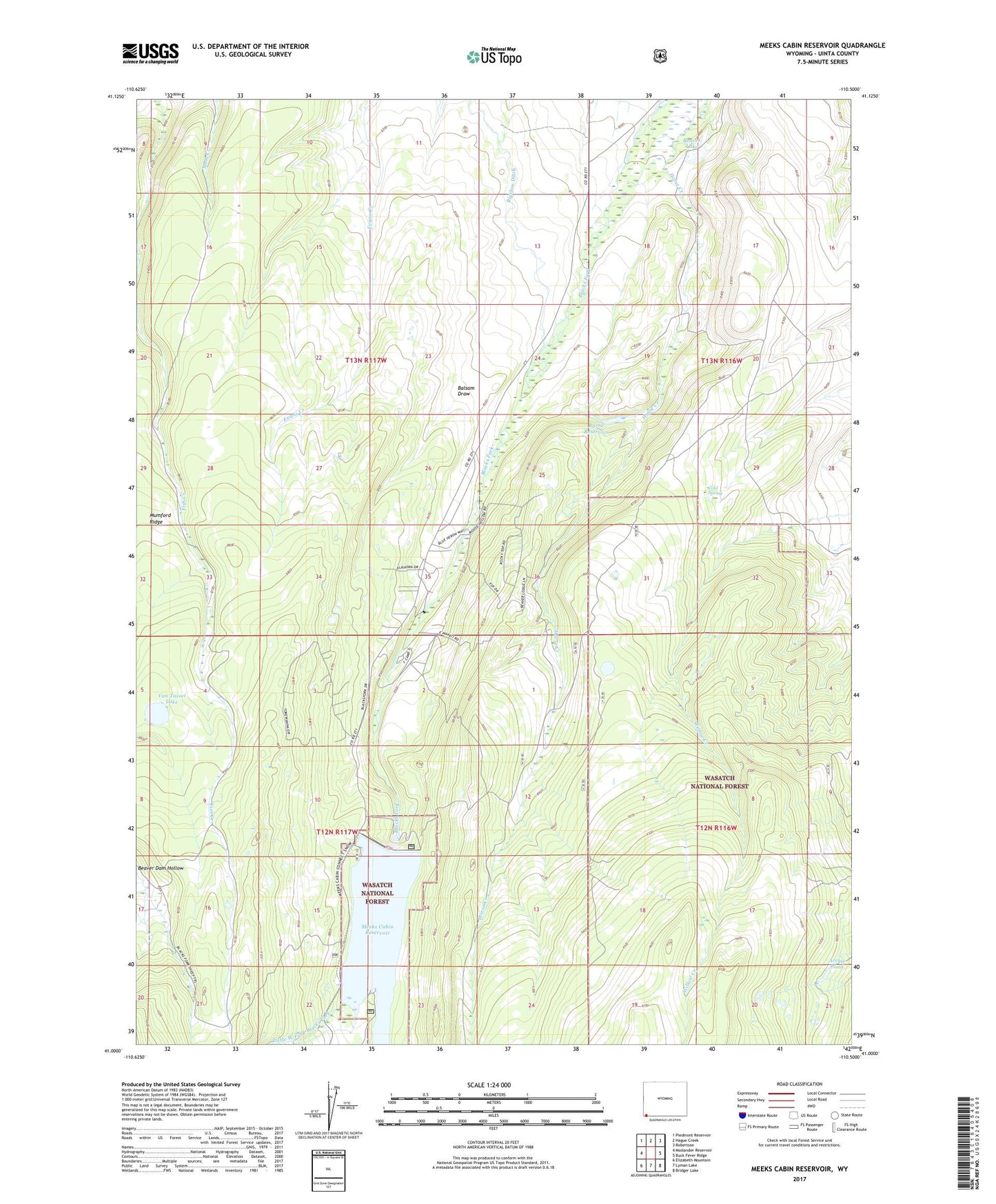
Meeks Cabin Reservoir Wyoming US Topo Map
Couldn't load pickup availability
Also explore the Meeks Cabin Reservoir Forest Service Topo of this same quad for updated USFS data
2021 topographic map quadrangle Meeks Cabin Reservoir in the state of Wyoming. Scale: 1:24000. Based on the newly updated USGS 7.5' US Topo map series, this map is in the following counties: Uinta. The map contains contour data, water features, and other items you are used to seeing on USGS maps, but also has updated roads and other features. This is the next generation of topographic maps. Printed on high-quality waterproof paper with UV fade-resistant inks.
Quads adjacent to this one:
West: Moslander Reservoir
Northwest: Piedmont Reservoir
North: Hague Creek
Northeast: Robertson
East: Buck Fever Ridge
Southeast: Bridger Lake
South: Lyman Lake
Southwest: Elizabeth Mountain
This map covers the same area as the classic USGS quad with code o41110a5.
Contains the following named places: Archie Pond, Balsam Draw, Beaver Lake, Beaver Lake Dam, Bigelow Ditch, Byrne Dam, Byrne Reservoir, Cold Spring, Drown Creek, Little West Fork Blacks Fork, Meeks Cabin, Meeks Cabin Campground, Meeks Cabin Dam, Meeks Cabin Reservoir, Uinta County Youth Camp, Van Tassel Lake, Van Tassel Lake Dam