MyTopo
Table Mountain Wyoming US Topo Map
Couldn't load pickup availability
Also explore the Table Mountain Forest Service Topo of this same quad for updated USFS data
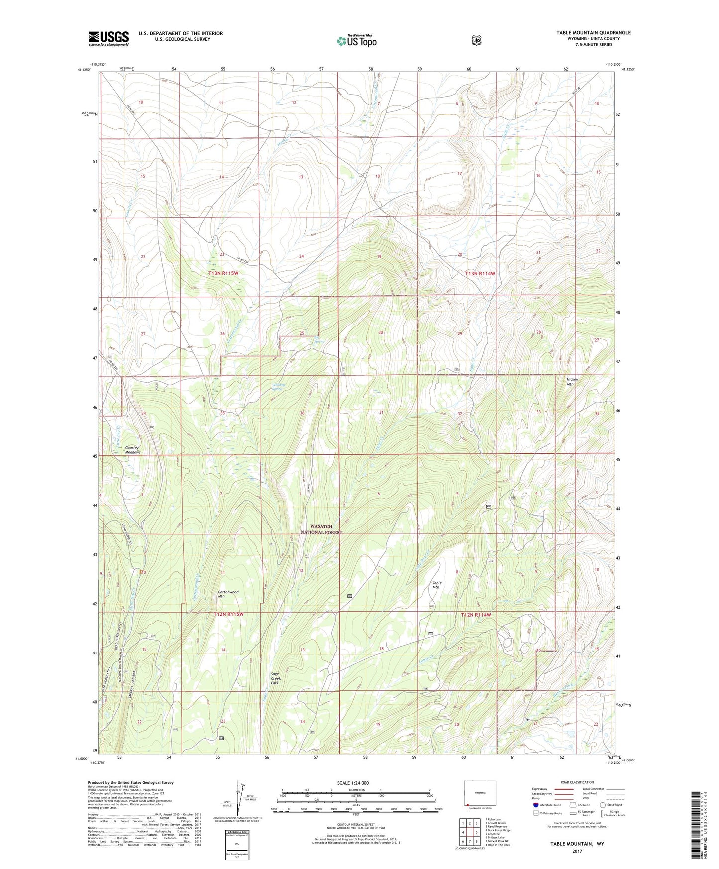
2021 topographic map quadrangle Table Mountain in the state of Wyoming. Scale: 1:24000. Based on the newly updated USGS 7.5' US Topo map series, this map is in the following counties: Uinta. The map contains contour data, water features, and other items you are used to seeing on USGS maps, but also has updated roads and other features. This is the next generation of topographic maps. Printed on high-quality waterproof paper with UV fade-resistant inks.
Quads adjacent to this one:
West: Buck Fever Ridge
Northwest: Robertson
North: Leavitt Bench
Northeast: Reed Reservoir
East: Lonetree
Southeast: Hole In The Rock
South: Gilbert Peak NE
Southwest: Bridger Lake
This map covers the same area as the classic USGS quad with code o40105h2.
Contains the following named places: Big Spring, Cottonwood Mountain, Gourley Meadows, Hickey Mountain, Honey Creek, Little Sage Creek, Sage Creek Park, Table Mountain, Whiskey Spring