MyTopo
Bull Elk Park Wyoming US Topo Map
Couldn't load pickup availability
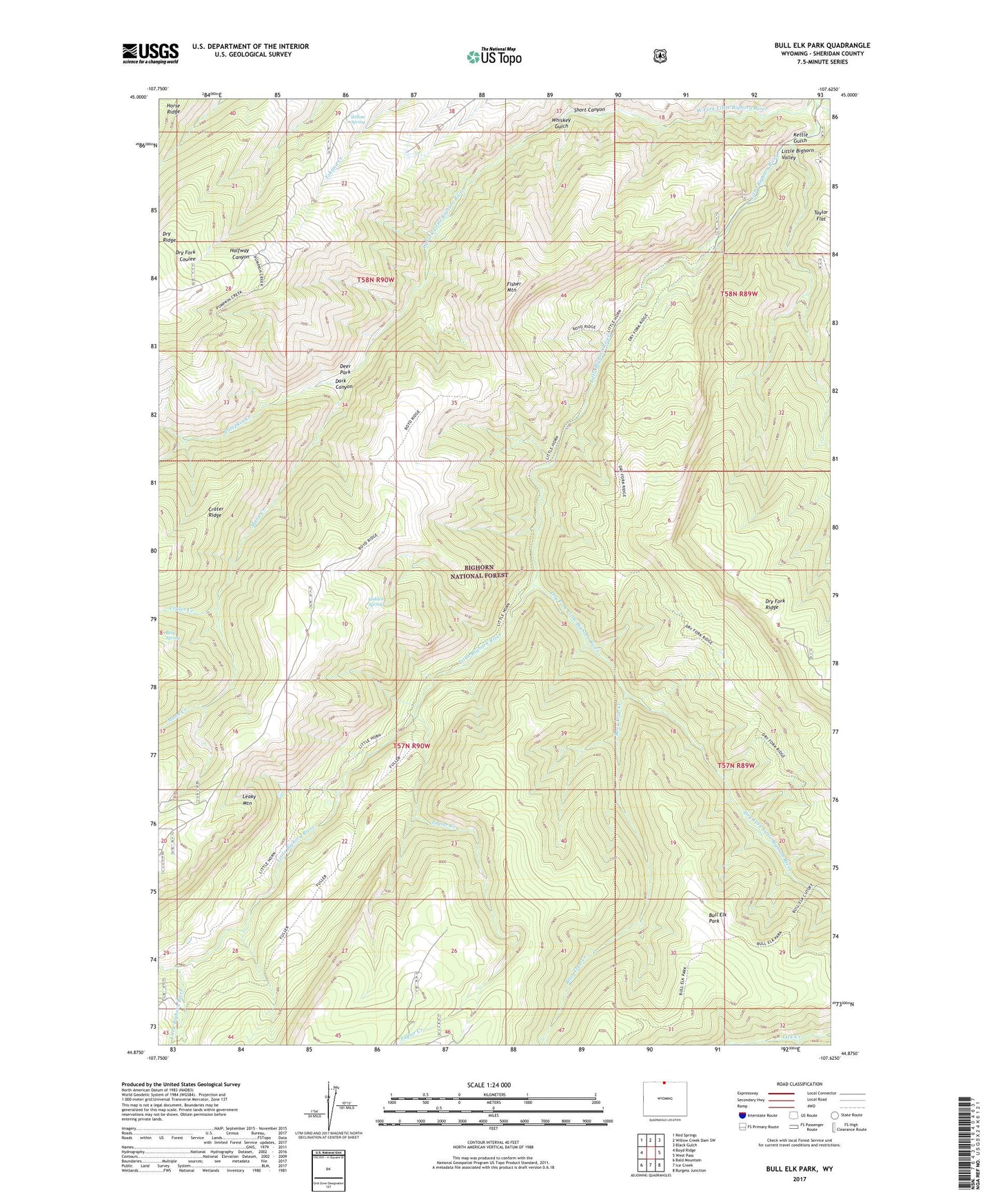
2021 topographic map quadrangle Bull Elk Park in the state of Wyoming. Scale: 1:24000. Based on the newly updated USGS 7.5' US Topo map series, this map is in the following counties: Sheridan. The map contains contour data, water features, and other items you are used to seeing on USGS maps, but also has updated roads and other features. This is the next generation of topographic maps. Printed on high-quality waterproof paper with UV fade-resistant inks.
Quads adjacent to this one:
West: Boyd Ridge
Northwest: Red Springs
North: Willow Creek Dam SW
Northeast: Black Gulch
East: West Pass
Southeast: Burgess Junction
South: Ice Creek
Southwest: Bald Mountain
Contains the following named places: Bear Spring, Bear Trap Creek, Bull Elk Park, Bull Elk Park Natural Area, Crater Creek, Cub Creek, Dark Canyon, Deer Park, Dry Fork Little Bighorn River, Dry Fork Trail, Dry Ridge, Elkhorn Creek, Fisher Mountain, Hidden Spring, Kettle Gulch, Leaky Mountain, Little Horn Trail, Mann Creek, Pumpkin Creek, Short Canyon, Taylor Creek, Wagon Box Creek, Whiskey Gulch, Willow Spring