MyTopo
Paradise Basin Wyoming US Topo Map
Couldn't load pickup availability
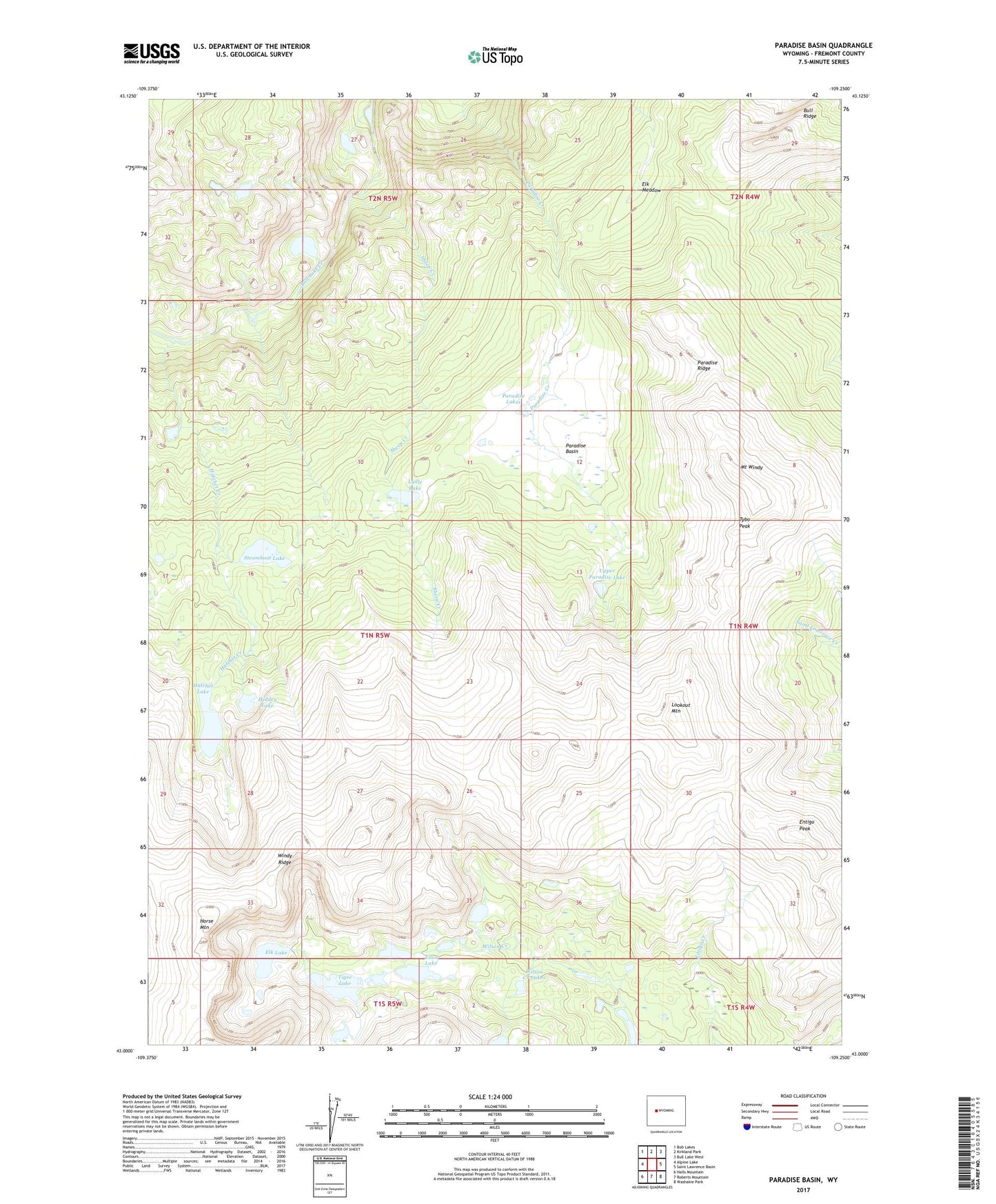
2021 topographic map quadrangle Paradise Basin in the state of Wyoming. Scale: 1:24000. Based on the newly updated USGS 7.5' US Topo map series, this map is in the following counties: Fremont. The map contains contour data, water features, and other items you are used to seeing on USGS maps, but also has updated roads and other features. This is the next generation of topographic maps. Printed on high-quality waterproof paper with UV fade-resistant inks.
Quads adjacent to this one:
West: Alpine Lake
Northwest: Bob Lakes
North: Kirkland Park
Northeast: Bull Lake West
East: Saint Lawrence Basin
Southeast: Washakie Park
South: Roberts Mountain
Southwest: Halls Mountain
This map covers the same area as the classic USGS quad with code o43109a3.
Contains the following named places: Elk Lake, Elk Meadow, Enos Lake, Entigo Peak, Hatchet Creek, Hatchet Lake, Hidden Lake, Horse Mountain, Lookout Mountain, Lydle Lake, Mount Windy, Paradise Basin, Paradise Lakes, Paradise Ridge, Sheep Creek, Steamboat Lake, Tigee Lake, Tybo Peak, Upper Paradise Lake, Wilson Creek Lakes