MyTopo
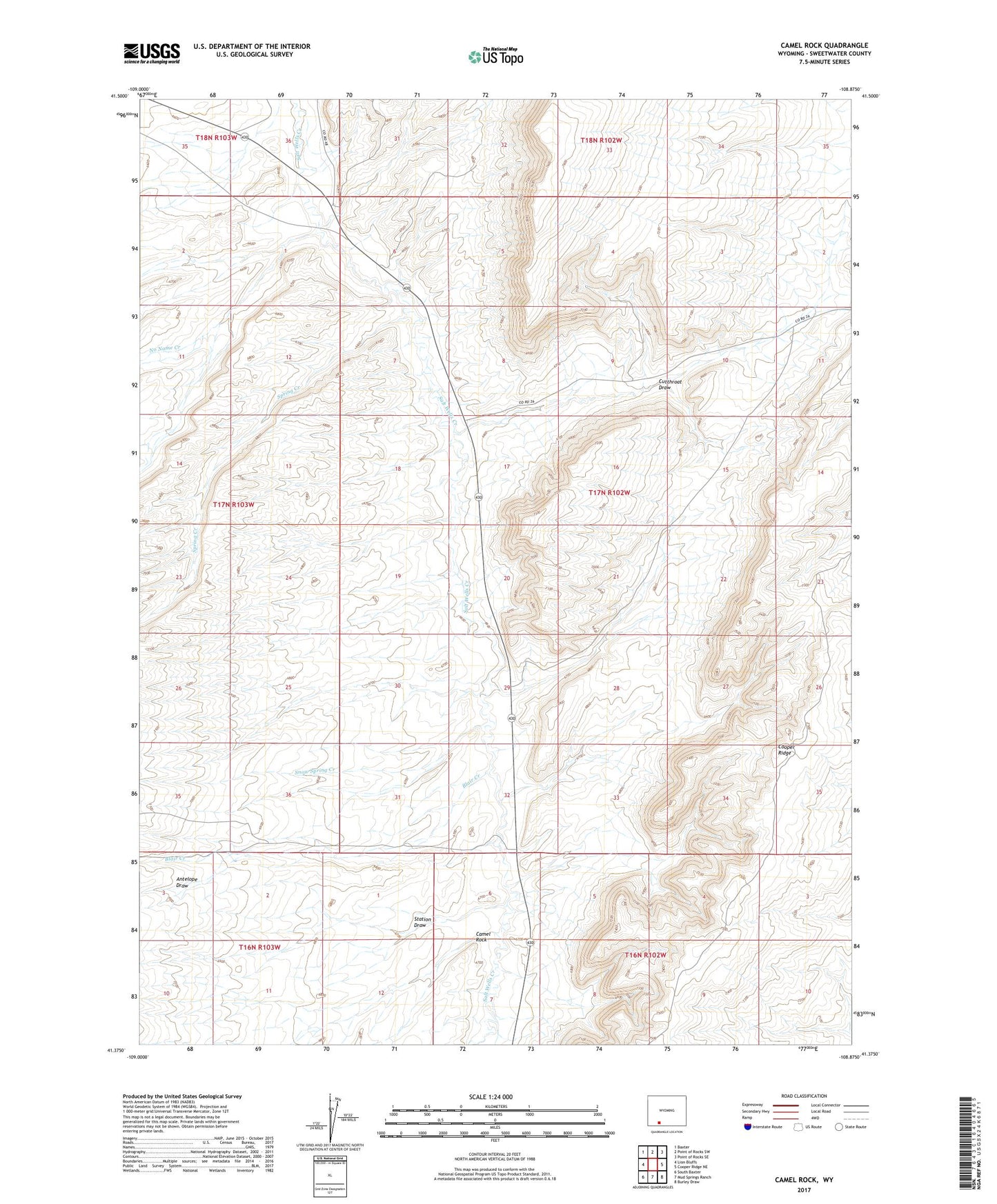
Camel Rock Wyoming US Topo Map
Couldn't load pickup availability
2021 topographic map quadrangle Camel Rock in the state of Wyoming. Scale: 1:24000. Based on the newly updated USGS 7.5' US Topo map series, this map is in the following counties: Sweetwater. The map contains contour data, water features, and other items you are used to seeing on USGS maps, but also has updated roads and other features. This is the next generation of topographic maps. Printed on high-quality waterproof paper with UV fade-resistant inks.
Quads adjacent to this one:
West: Lion Bluffs
Northwest: Baxter
North: Point of Rocks SW
Northeast: Point of Rocks SE
East: Cooper Ridge NE
Southeast: Burley Draw
South: Mud Springs Ranch
Southwest: South Baxter
This map covers the same area as the classic USGS quad with code o41108d8.
Contains the following named places: Antelope Draw, Blair Creek, Camel Rock, Cooper Ridge, Cutthroat Draw, No Name Creek, Snow Spring Creek, Spring Creek, Station Draw, ZIP Code: 82901