MyTopo
Lion Bluffs Wyoming US Topo Map
Couldn't load pickup availability
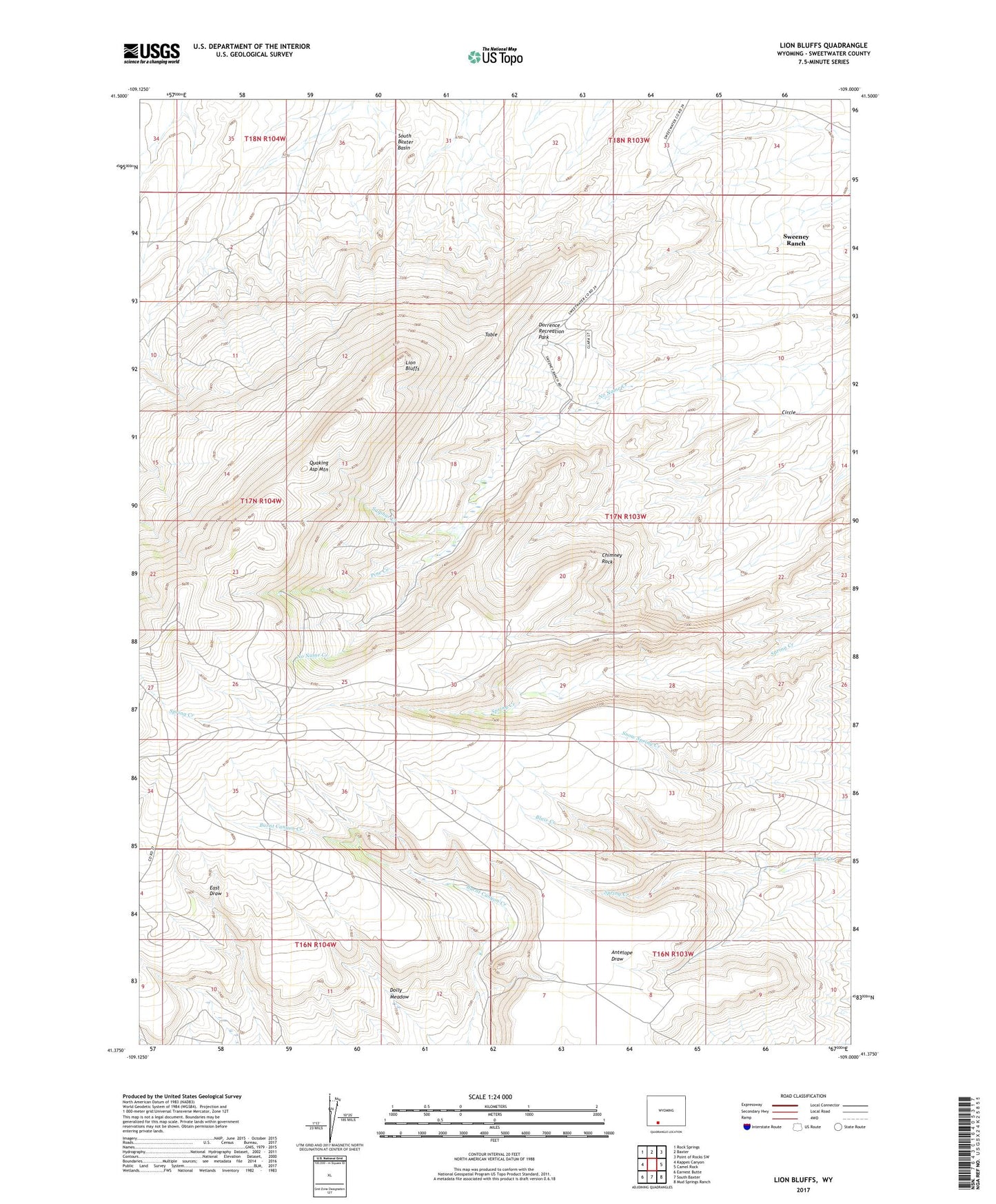
2021 topographic map quadrangle Lion Bluffs in the state of Wyoming. Scale: 1:24000. Based on the newly updated USGS 7.5' US Topo map series, this map is in the following counties: Sweetwater. The map contains contour data, water features, and other items you are used to seeing on USGS maps, but also has updated roads and other features. This is the next generation of topographic maps. Printed on high-quality waterproof paper with UV fade-resistant inks.
Quads adjacent to this one:
West: Kappes Canyon
Northwest: Rock Springs
North: Baxter
Northeast: Point of Rocks SW
East: Camel Rock
Southeast: Mud Springs Ranch
South: South Baxter
Southwest: Earnest Butte
This map covers the same area as the classic USGS quad with code o41109d1.
Contains the following named places: Aspen Mountain Mine, Chimney Rock, Circle, Dolly Meadow, Dorrence Recreation Park, KGWR-TV (Rock Springs), KQSW-FM (Rock Springs), KSIT-FM (Rock Springs), Lion Bluffs, Pine Creek, Quaking Asp Mountain, Spring Creek, Sulphur Creek, Sweeney Ranch, Sweeney Ranch Census Designated Place, Table, Three Patches Picnic Area